Area Overview for L22 6QD
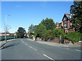
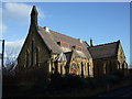
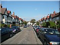
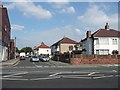
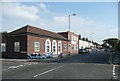
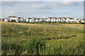
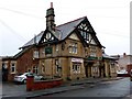
Photos of L22 6QD


Area Information
Living in L22 6QD means being part of a small, tightly knit residential cluster in England with a population of 1,461. This area is defined by its compact size and proximity to key transport links, making it a practical choice for those seeking a balance between urban convenience and quieter living. The community here is predominantly composed of adults aged 30–64, reflecting a mature demographic that likely values stability and established infrastructure. Daily life is shaped by the area’s connectivity to rail, ferry, and retail hubs, which provide easy access to nearby cities and services. While the postcode covers a limited geographic footprint, its strategic placement near major routes ensures residents are never far from essential amenities. The area’s low flood risk and below-average crime rates further contribute to a sense of security, making it appealing for families and professionals alike. For those prioritising safety, practicality, and proximity to transport, L22 6QD offers a straightforward, no-frills living experience.
- Area Type
- Postcode
- Area Size
- Not available
- Population
- 1461
- Population Density
- 5468 people/km²
The property market in L22 6QD is characterised by a high rate of home ownership (74%), suggesting that most properties are owner-occupied rather than rented out. The accommodation type is predominantly houses, which is unusual for areas with higher density but aligns with L22 6QD’s small, residential nature. This focus on houses implies a market that may appeal to those seeking space and privacy, though the limited area size means the housing stock is unlikely to be extensive. For buyers, this means a small pool of properties, which could lead to competitive conditions when opportunities arise. The lack of flats or apartments also suggests that the area is not a hotspot for rental investors. Prospective buyers should consider the compact size of the postcode when exploring nearby options, as the immediate surroundings may offer more variety in housing types.
House Prices in L22 6QD
No properties found in this postcode.
Energy Efficiency in L22 6QD
Residents of L22 6QD have access to a range of essential amenities within practical reach. The area is served by five retail outlets, including Co-op Waterloo and Tesco Liverpool, ensuring daily shopping needs are met. Rail stations like Hall Road and Waterloo provide easy access to urban centres, while ferry terminals such as Liverpool Belfast and Seacombe connect to nearby islands and cities. These transport options are complemented by the proximity of major roads, facilitating travel to surrounding areas. The presence of multiple retail and transport hubs suggests a community that values convenience and connectivity. While the area itself is small, the surrounding infrastructure ensures residents are not isolated from broader opportunities. The mix of retail, transport, and ferry access creates a functional lifestyle, ideal for those prioritising practicality over sprawling leisure options.
Amenities
Schools
| Rank | School | Type | Entry gender | Ages |
|---|
Explore more schools in this area
Go to Schools tabDemographics
The community in L22 6QD is predominantly composed of adults aged 30–64, with a median age of 47. This suggests a population that is largely settled, with few young families or retirees. Home ownership is high, at 74%, indicating that most residents live in properties they own rather than rent. The accommodation type is primarily houses, which aligns with the area’s residential character. The predominant ethnic group is White, reflecting a homogenous demographic profile. While no specific data on deprivation is provided, the high home ownership rate and low crime risk imply a stable, low-pressure environment. This stability may translate to a community where long-term residents are common, and local amenities are used regularly. The absence of significant diversity data means the area’s social fabric is likely shaped by shared cultural and economic factors.
Household Size
Accommodation Type
Tenure
Ethnic Group
Religion
Household Composition
Age
Household Deprivation
NS-SEC
Explore more demographic insights in this area
Go to Demographics tabPlanning
Planning Constraints
- Flood RiskPremium
- Ramsar Wetland SitesPremium
- Area of Outstanding Natural BeautyPremium
- Protected Nature ReservePremium
- Protected WoodlandPremium