Area Overview for L22 1RA
Photos of L22 1RA
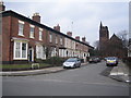
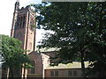
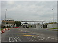
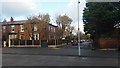
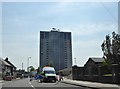
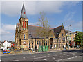
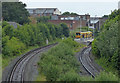
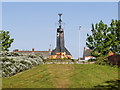
48 photos from this area
Area Information
Key information about the L22 1RA including its size, population, and administrative classification.
- Area Type
- Postcode
- Area Size
- 1.1 hectares
- Population
- 1572
- Population Density
- 1326 people/km²
House Prices in L22 1RA
29
Properties
£232,714
Average Sold Price
£28,000
Lowest Price
£410,000
Highest Price
Showing 29 properties
| Address | Type | Beds | Baths | Last Sale Price | Last Sale Date | |
|---|---|---|---|---|---|---|
| 37 Great Georges Road, Waterloo, L22 1RA | house | - | - | £410,000 | Feb 2018 | |
| 13 Great Georges Road, Waterloo, L22 1RA | house | 4 | 1 | £165,000 | Oct 2017 | |
| 33 Great Georges Road, Waterloo, L22 1RA | Semi-detached | 5 | 1 | £345,000 | Nov 2016 | |
| 15 Great Georges Road, Waterloo, L22 1RA | Semi-detached | - | - | £157,000 | Jul 2008 | |
| 23 Great Georges Road, Waterloo, L22 1RA | Semi-detached | 7 | 3 | £397,000 | Apr 2008 | |
| 5 Great Georges Road, Waterloo, L22 1RA | Flat | - | - | £28,000 | Apr 1999 | |
| 31 Great Georges Road, Waterloo, L22 1RA | house | - | - | £127,000 | Jul 1998 | |
| Flat 5, 29 Great Georges Road, Waterloo, L22 1RA | Flat | 1 | 1 | - | - | |
| 7 Great Georges Road, Waterloo, L22 1RA | Flat | 7 | - | - | - | |
| 9 Great Georges Road, Waterloo, L22 1RA | house | - | - | - | - |
Page 1 of 3
Energy Efficiency in L22 1RA
Amenities
Schools
| Rank | School | Type | Entry gender | Ages |
|---|
Explore more schools in this area
Go to Schools tabDemographics
Household Size
One person
most common
Accommodation Type
Flats
most common
Tenure
35
majority
Ethnic Group
White
most common
Religion
N/A
most common
Household Composition
N/A
most common
Age
47
median
Adults (30-64 years)
most common
Household Deprivation
N/A
with no deprivation
NS-SEC
30
in Lower managerial occupations
Explore more demographic insights in this area
Go to Demographics tabPlanning
Planning Constraints
- Flood RiskPremium
- Ramsar Wetland SitesPremium
- Area of Outstanding Natural BeautyPremium
- Protected Nature ReservePremium
- Protected WoodlandPremium