Area Overview for L22 0PQ
Photos of L22 0PQ


Area Information
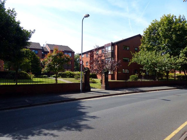
Living in L22 0PQ means being part of a small, tightly knit residential cluster in England, home to 1,581 people. This area is defined by its compact size and proximity to essential services, making it practical for daily life. The community is predominantly composed of adults aged 30–64, with a median age of 47, suggesting a mature, stable population. The area is largely composed of houses, with 51% of homes owned by residents, reflecting a mix of owner-occupied properties and rentals. While the area lacks large-scale amenities, its strategic location offers access to nearby rail, retail, and ferry services. The absence of environmental constraints like protected woodlands or AONB designations means development is unencumbered, though the high crime risk score of 32/100 warrants caution. For those prioritising convenience and connectivity, L22 0PQ offers a compact base with immediate access to urban infrastructure, albeit within a small, defined footprint.
- Area Type
- Postcode
- Area Size
- Not available
- Population
- 1581
- Population Density
- 6362 people/km²
The property market in L22 0PQ is characterised by a 51% home ownership rate, indicating a balance between owner-occupied and rental properties. The area is primarily composed of houses, which suggests a focus on family homes rather than apartments or flats. This makes it a niche market, particularly for buyers seeking single-family residences in a compact, defined area. However, the small size of the postcode means housing stock is limited, and buyers may need to consider nearby regions for more options. The lack of data on property prices or recent sales trends means it is difficult to assess whether the market is growing or stagnant, but the dominance of houses implies a conservative, traditional housing landscape. For those prioritising ownership, the area offers a stable, if unexciting, proposition.
House Prices in L22 0PQ
No properties found in this postcode.
Energy Efficiency in L22 0PQ
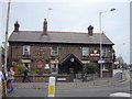
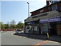
Daily life in L22 0PQ is shaped by its proximity to retail, transport, and ferry hubs. The area’s five rail stations, including Waterloo Railway Station, offer easy access to urban centres, while nearby shops like Co-op Waterloo and Tesco Liverpool provide essentials. For those who enjoy water-based travel, ferry terminals such as Liverpool Belfast Ferry Terminal Bootle and Seacombe Ferry Terminal connect residents to destinations like the Isle of Man and Dublin. Though the area lacks large parks or leisure facilities, its compact size ensures amenities are within walking distance. The presence of multiple retail outlets and transport links suggests a practical, convenience-driven lifestyle, ideal for those prioritising accessibility over sprawling green spaces.
Amenities
Schools
The nearest school to L22 0PQ is Waterloo Primary School, a primary institution listed twice in the data. No secondary schools or other educational institutions are mentioned, which may limit options for families requiring a full range of schooling. The presence of a primary school suggests the area is suitable for young children, but the absence of secondary schools could necessitate commuting to nearby towns. The Ofsted rating for Waterloo Primary School is not provided, so its quality remains unspecified. For families, the single primary school may be adequate for younger children, but the lack of additional educational facilities could be a drawback for those requiring a broader range of schools.
| Rank | School | Type | Entry gender | Ages |
|---|
Explore more schools in this area
Go to Schools tabDemographics
The population of L22 0PQ is 1,581, with a median age of 47, indicating a community skewed towards middle-aged adults. The most common age range is 30–64, suggesting a stable demographic with fewer young families or elderly residents. Home ownership stands at 51%, meaning nearly half of properties are rented, pointing to a mix of long-term residents and transient occupants. The area is predominantly composed of houses, with no data on flats or other accommodation types. The predominant ethnic group is White, though no specific diversity statistics are provided. The absence of detailed deprivation data means it is unclear how economic factors influence quality of life, but the age profile and ownership figures suggest a community focused on established living rather than rapid growth or change.
Household Size
Accommodation Type
Tenure
Ethnic Group
Religion
Household Composition
Age
Household Deprivation
NS-SEC
Explore more demographic insights in this area
Go to Demographics tabPlanning
Planning Constraints
- Flood RiskPremium
- Ramsar Wetland SitesPremium
- Area of Outstanding Natural BeautyPremium
- Protected Nature ReservePremium
- Protected WoodlandPremium