Area Overview for L22 0NB
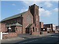
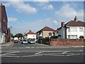
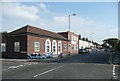
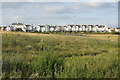
Photos of L22 0NB


Area Information
Living in L22 0NB means being part of a small, tightly knit residential cluster in England with a population of 1,581. This area is characterised by its compact nature, where daily life is shaped by proximity to essential services. Residents benefit from a mix of practical amenities, including multiple retail outlets, rail connections, and ferry terminals within easy reach. The community is predominantly composed of adults aged 30–64, reflecting a mature demographic. While the area lacks large-scale infrastructure, its small size fosters a sense of familiarity. The presence of Waterloo Primary School, though listed twice in the data, underscores the focus on local education. For those prioritising connectivity, the broadband score of 99 ensures reliable internet access, supporting both work and leisure. However, the area’s compactness also means that residents must navigate a balance between convenience and limited expansion. Understanding the local context—such as the high crime risk and the absence of natural constraints—helps shape realistic expectations for living here.
- Area Type
- Postcode
- Area Size
- Not available
- Population
- 1581
- Population Density
- 6362 people/km²
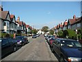
The property market in L22 0NB reflects a modestly owner-occupied area, with 51% of homes owned by residents. The predominant accommodation type is houses, which contrasts with areas where flats or apartments dominate. This suggests a market more aligned with traditional family homes rather than high-density living. Given the small population and limited expansion, the housing stock is likely to be well-established, with properties potentially offering character or historical features. For buyers, this means a focus on individual homes rather than rental opportunities, which are less prominent here. The compact nature of the area may limit availability, making properties in L22 0NB more competitive for those seeking a stable, low-maintenance environment. However, the lack of newer developments could mean fewer modern amenities or energy-efficient features in existing homes.
House Prices in L22 0NB
No properties found in this postcode.
Energy Efficiency in L22 0NB
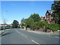
The lifestyle in L22 0NB is shaped by its proximity to retail, leisure, and transport hubs. Nearby shops include Iceland Waterloo, Co-op Waterloo, and Tesco Liverpool, providing access to groceries, household goods, and everyday essentials. These retail options are within practical reach, reducing the need for long commutes. The area’s ferry terminals, such as Liverpool Belfast Ferry Terminal Bootle, connect residents to nearby towns and islands, enhancing mobility for both leisure and commuting. While there is no mention of parks or recreational spaces in the data, the rail stations and retail options suggest a focus on practicality over green spaces. The mix of retail and transport amenities supports a convenient, if compact, lifestyle. However, the absence of named parks or leisure facilities means residents may need to travel further for outdoor activities or community events.
Amenities
Schools
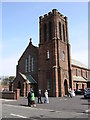
The nearest school to L22 0NB is Waterloo Primary School, which serves the local community. The data lists this school twice, but it is the only educational institution explicitly mentioned. As a primary school, it caters to younger children, though no secondary schools are noted in the area. This suggests that families with children may need to travel to nearby postcodes for secondary education. The presence of a primary school indicates a focus on early education, but the absence of further schooling options could be a consideration for those planning long-term family needs. The school’s Ofsted rating is not provided, so its quality remains unspecified. For parents, this means evaluating the broader regional school network beyond L22 0NB to ensure comprehensive educational provision for growing families.
| Rank | School | Type | Entry gender | Ages |
|---|
Explore more schools in this area
Go to Schools tabDemographics
The population of L22 0NB is 1,581, with a median age of 47. This suggests a community skewed towards middle-aged and older residents, with the most common age range being adults aged 30–64. Home ownership stands at 51%, indicating a modest balance between owner-occupied and rental properties. The predominant accommodation type is houses, which aligns with the area’s residential character. Ethnically, the population is predominantly White, with no specific data on other groups provided. The absence of detailed diversity metrics means the community’s composition remains largely defined by this demographic. The age profile implies a stable, established population, which may influence local services and amenities. However, the lack of younger families or students is notable, given the presence of only one primary school. This suggests a community focused on older residents or those without dependent children.
Household Size
Accommodation Type
Tenure
Ethnic Group
Religion
Household Composition
Age
Household Deprivation
NS-SEC
Explore more demographic insights in this area
Go to Demographics tabPlanning
Planning Constraints
- Flood RiskPremium
- Ramsar Wetland SitesPremium
- Area of Outstanding Natural BeautyPremium
- Protected Nature ReservePremium
- Protected WoodlandPremium