Area Overview for L21 8QA
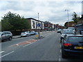
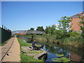
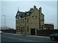
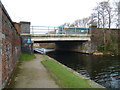
Photos of L21 8QA


Area Information
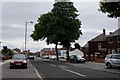
L21 8QA is a small residential cluster in England, home to 1353 residents. This area is characterised by its compact size and established housing stock, with a majority of properties being houses. The population skews towards adults aged 30–64, reflecting a community with a strong presence of families and middle-aged individuals. Daily life here is shaped by proximity to essential services and transport links. Residents benefit from nearby schools, retail outlets, and rail networks, which support both practical needs and connectivity. The area’s modest scale means it is not a sprawling suburb but a focused neighbourhood with a distinct local identity. While it lacks the density of larger urban centres, its accessibility to Liverpool’s transport infrastructure and amenities makes it a viable option for those seeking a quieter, more settled environment. The median age of 47 suggests a mature demographic, which may influence the pace of community activity and local services. For buyers, this area offers a snapshot of suburban living with a balance of convenience and tranquillity.
- Area Type
- Postcode
- Area Size
- Not available
- Population
- 1353
- Population Density
- 6358 people/km²
The property market in L21 8QA is primarily owner-occupied, with 56% of homes owned by residents. This indicates a community where long-term residency is common, though 44% of properties are rented, suggesting a modest rental market. The accommodation type is predominantly houses, which may appeal to families or those seeking more space. Given the area’s small size, the housing stock is likely limited, making it a niche market for buyers. The focus on owner-occupation suggests that properties may be held for longer periods, potentially influencing availability for new buyers. For those considering the area, the prevalence of houses could mean fewer high-density developments, but it also implies a quieter, more suburban environment. Buyers should note that the market is not characterised by high turnover, which may affect both pricing and the range of properties on offer.
House Prices in L21 8QA
No properties found in this postcode.
Energy Efficiency in L21 8QA
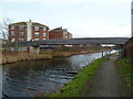
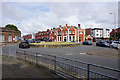
The lifestyle in L21 8QA is supported by a range of nearby amenities within practical reach. Retail options include Asda Linacre, Aldi Bootle, and Tesco Litherland, providing everyday shopping needs. The rail network offers access to stations like Bootle Oriel Road Railway Station, facilitating travel to nearby towns and cities. Ferry terminals such as Liverpool Belfast Ferry Terminal Bootle and Seacombe Ferry Terminal connect residents to coastal and intercity routes, enhancing mobility. While the area lacks detailed information on parks or leisure facilities, the presence of multiple retail and transport hubs suggests a practical, service-oriented lifestyle. The mix of shops, rail, and ferry services contributes to a convenient daily life, particularly for those who rely on public transport or need regular access to retail and travel options.
Amenities
Schools
The nearest school to L21 8QA is Linacre Primary School, a primary institution serving the local community. While the data lists this school twice, it is the only educational facility explicitly mentioned. The presence of a primary school suggests that the area is well-suited for families with young children, though no secondary schools or further education institutions are detailed. The absence of additional schools may require families to travel to nearby areas for secondary education. The single primary school could indicate a focused local provision, but the lack of diversity in school types may limit options for parents seeking a range of educational environments. For families prioritising proximity to schools, Linacre Primary School is a key asset of the area.
| Rank | School | Type | Entry gender | Ages |
|---|
Explore more schools in this area
Go to Schools tabDemographics
The population of L21 8QA has a median age of 47, with the largest age group being adults aged 30–64. This suggests a community with a strong presence of working-age individuals and families. Home ownership stands at 56%, meaning nearly half of residents rent their homes. The accommodation type is predominantly houses, which aligns with the area’s residential character. The predominant ethnic group is White, though no specific data on diversity or minority representation is provided. The absence of detailed deprivation metrics means that quality of life factors such as access to services or employment opportunities cannot be assessed here. However, the presence of schools, retail, and transport links implies a level of infrastructure that supports daily living. The age profile suggests a stable, long-term resident base, which may contribute to a sense of continuity in the local area.
Household Size
Accommodation Type
Tenure
Ethnic Group
Religion
Household Composition
Age
Household Deprivation
NS-SEC
Explore more demographic insights in this area
Go to Demographics tabPlanning
Planning Constraints
- Flood RiskPremium
- Ramsar Wetland SitesPremium
- Area of Outstanding Natural BeautyPremium
- Protected Nature ReservePremium
- Protected WoodlandPremium