Area Overview for L21 8PX
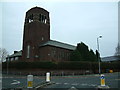
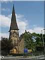
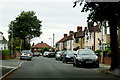
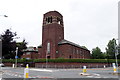
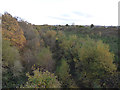
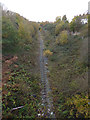
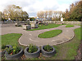
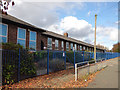
Photos of L21 8PX
Area Information
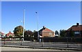
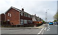
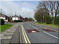
Living in L21 8PX means being part of a small, tightly knit residential cluster in England, home to 2,470 people. This area is defined by its compact size and the presence of family-oriented housing, with the majority of homes being owner-occupied. The community is predominantly composed of adults aged 30–64, reflecting a mature demographic with established roots. Daily life here is shaped by proximity to essential services, including multiple schools, rail links, and ferry terminals. While the area lacks large-scale commercial hubs, its practical connectivity to nearby towns and cities ensures residents have access to broader opportunities. The low flood risk and absence of environmental constraints make it a stable place to settle. For those seeking a quiet, family-focused environment with access to transport and amenities, L21 8PX offers a balanced blend of residential comfort and practicality.
- Area Type
- Postcode
- Area Size
- Not available
- Population
- 2470
- Population Density
- 4655 people/km²
The property market in L21 8PX is characterised by high home ownership (85%) and a focus on houses rather than flats. This suggests a community where long-term residency is common, with fewer rental properties available. The small residential cluster means the housing stock is limited, but the presence of owner-occupied homes indicates a stable market with potential for value retention. Buyers should consider that the area’s size restricts the number of properties available, though the emphasis on houses may appeal to those seeking family homes. Given the low crime risk and absence of environmental constraints, this area could be attractive to investors or first-time buyers looking for a secure, low-maintenance property in a quiet setting.
House Prices in L21 8PX
No properties found in this postcode.
Energy Efficiency in L21 8PX
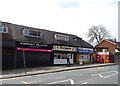
Residents of L21 8PX benefit from nearby retail options, including Tesco Litherland, Spar, and Tesco Sefton, which cater to everyday shopping needs. The area’s rail stations and ferry terminals provide access to broader leisure and employment opportunities, while the absence of large-scale commercial hubs maintains a quiet, residential character. The presence of multiple schools and low environmental risks contributes to a family-friendly lifestyle. Though the data does not specify parks or recreational spaces, the practical reach of amenities suggests a balance between convenience and a low-key, community-oriented way of life.
Amenities
Schools
Residents of L21 8PX have access to three primary schools within practical reach. St Philip’s Church of England Controlled Primary School and St Robert Bellarmine Catholic Primary School both hold Ofsted ratings of ‘good’ and ‘outstanding’ respectively, indicating high standards of education. St Wilfrid’s Catholic High School, though listed as a primary school, lacks an Ofsted rating in the data. The presence of multiple primary schools suggests a strong local education network, ideal for families with young children. The mix of faith-based and non-faith-based institutions provides choice, though the absence of secondary school data means parents may need to consider nearby towns for secondary education.
| Rank | School | Type | Entry gender | Ages |
|---|
Explore more schools in this area
Go to Schools tabDemographics
The population of L21 8PX is 2,470, with a median age of 47 and the most common age range being adults aged 30–64. This suggests a community of settled individuals, many of whom are likely to be homeowners. Home ownership here is high, at 85%, with the predominant accommodation type being houses rather than flats. The majority of residents identify as White, reflecting a homogenous ethnic profile. This demographic structure indicates a stable, long-term resident base with lower turnover. The absence of specific deprivation data means the area’s quality of life is inferred from its infrastructure and services. With no mention of social or economic challenges in the data, it appears to be a place where families and older adults coexist in a structured, low-risk environment.
Household Size
Accommodation Type
Tenure
Ethnic Group
Religion
Household Composition
Age
Household Deprivation
NS-SEC
Explore more demographic insights in this area
Go to Demographics tabPlanning
Planning Constraints
- Flood RiskPremium
- Ramsar Wetland SitesPremium
- Area of Outstanding Natural BeautyPremium
- Protected Nature ReservePremium
- Protected WoodlandPremium