Area Overview for L21 8JE
Photos of L21 8JE
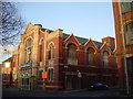
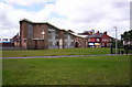

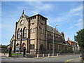
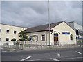
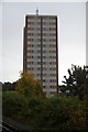
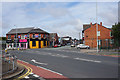
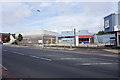
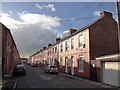
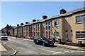
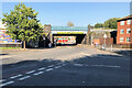

30 photos from this area
Area Information
Key information about the L21 8JE including its size, population, and administrative classification.
- Area Type
- Postcode
- Area Size
- 2970 m²
- Population
- 1554
- Population Density
- 7682 people/km²
House Prices in L21 8JE
25
Properties
£58,305
Average Sold Price
£21,525
Lowest Price
£110,000
Highest Price
Showing 25 properties
| Address | Type | Beds | Baths | Last Sale Price | Last Sale Date | |
|---|---|---|---|---|---|---|
| 27 Blisworth Street, Litherland, L21 8JE | Terraced | 3 | 1 | £110,000 | Sep 2025 | |
| 29 Blisworth Street, Litherland, L21 8JE | house | 2 | - | £75,140 | Feb 2023 | |
| 43 Blisworth Street, Litherland, L21 8JE | Terraced | 3 | 1 | £60,000 | Sep 2021 | |
| 19 Blisworth Street, Litherland, L21 8JE | Terraced | 3 | 1 | £64,000 | Feb 2020 | |
| 35 Blisworth Street, Litherland, L21 8JE | house | 2 | 1 | £66,000 | Dec 2018 | |
| 25 Blisworth Street, Litherland, L21 8JE | Terraced | 3 | 1 | £67,000 | Nov 2017 | |
| 3 Blisworth Street, Litherland, L21 8JE | house | - | - | £65,000 | Feb 2013 | |
| 37 Blisworth Street, Litherland, L21 8JE | house | - | - | £70,000 | Jul 2010 | |
| 33 Blisworth Street, Litherland, L21 8JE | Terraced | - | - | £42,500 | Mar 2004 | |
| 21 Blisworth Street, Litherland, L21 8JE | Terraced | - | - | £30,500 | Oct 2002 |
Page 1 of 3
Energy Efficiency in L21 8JE
Amenities
Schools
| Rank | School | Type | Entry gender | Ages |
|---|
Explore more schools in this area
Go to Schools tabDemographics
Household Size
One person
most common
Accommodation Type
Houses
most common
Tenure
36
majority
Ethnic Group
White
most common
Religion
N/A
most common
Household Composition
N/A
most common
Age
47
median
Adults (30-64 years)
most common
Household Deprivation
N/A
with no deprivation
NS-SEC
16
in Lower managerial occupations
Explore more demographic insights in this area
Go to Demographics tabPlanning
Planning Constraints
- Flood RiskPremium
- Ramsar Wetland SitesPremium
- Area of Outstanding Natural BeautyPremium
- Protected Nature ReservePremium
- Protected WoodlandPremium