Area Overview for L21 4YX
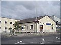
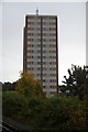
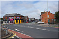
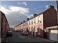
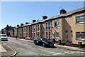
Photos of L21 4YX


Area Information
Living in L21 4YX offers a quiet, residential lifestyle within a small cluster of homes. With a population of 1,414, this area is characterised by a mature demographic, where the median age of 47 suggests a community of established residents. The area is primarily composed of houses, reflecting a more traditional housing stock. Proximity to essential amenities, including multiple railway stations and ferry terminals, ensures connectivity to nearby towns and cities. For families, the presence of Sand Dunes Nursery School and Rawson Road Primary School within reach adds to the appeal. However, the area’s modest size means it is best suited for those prioritising convenience over expansive space. While broadband connectivity is excellent, with a score of 100, mobile coverage is good but not exceptional. The area’s safety profile is mixed: flood risk is low, but crime risk is average, requiring standard precautions. L21 4YX is ideal for buyers seeking a settled, community-focused environment with practical access to transport and services.
- Area Type
- Postcode
- Area Size
- Not available
- Population
- 1414
- Population Density
- 7674 people/km²
The property market in L21 4YX is defined by a 33% home ownership rate, with houses being the primary accommodation type. This suggests a modest, family-oriented housing stock rather than a high-density or rental-focused area. The relatively low proportion of owner-occupied homes implies a significant portion of the housing stock is rented, which may influence property values and investment potential. Given the area’s small size, the market is likely limited to a few key streets, with limited scope for expansion. Buyers should consider that the housing stock is older, with fewer modern developments. The presence of nearby rail and ferry links may enhance the area’s appeal for commuters, though the small population means the market is niche. For those seeking a low-maintenance, stable property with proximity to essential services, L21 4YX offers a practical option.
House Prices in L21 4YX
No properties found in this postcode.
Energy Efficiency in L21 4YX
The lifestyle in L21 4YX is shaped by its proximity to a range of amenities. Residents can access shops like Lidl Wellington and Tesco Litherland, providing essentials for daily living. The presence of multiple railway stations and ferry terminals ensures easy travel to nearby towns and cities, supporting both work and leisure. While the area lacks large parks or recreational spaces, its practical connectivity to larger urban centres means residents can access cultural and leisure opportunities beyond the postcode. The availability of nurseries and primary schools adds to the convenience for families, reducing the need for long commutes. Overall, L21 4YX offers a compact, functional lifestyle with a balance of local services and regional connectivity, ideal for those prioritising practicality over expansive amenities.
Amenities
Schools
Residents of L21 4YX have access to Sand Dunes Nursery School and Rawson Road Primary School, both within practical reach. The nursery caters to younger children, while the primary school serves the needs of families with school-age children. The absence of secondary schools in the immediate area means families may need to consider commuting to nearby towns for secondary education. However, the availability of both nursery and primary schools within the postcode reduces the need for long-distance travel for younger children. The mix of school types supports a seamless transition for families, though the lack of comprehensive data on Ofsted ratings means potential buyers should conduct further research into educational standards. For those prioritising proximity to schools, L21 4YX offers a convenient starting point.
| Rank | School | Type | Entry gender | Ages |
|---|
Explore more schools in this area
Go to Schools tabDemographics
The community in L21 4YX is predominantly composed of adults aged 30–64, with a median age of 47. This suggests a mature population, likely with established careers and families. Home ownership stands at 33%, indicating a mix of owner-occupied properties and rental homes. The accommodation type is primarily houses, reflecting a more traditional housing stock. The predominant ethnic group is White, which aligns with broader regional trends. While specific data on deprivation is not provided, the age profile and home ownership rate suggest a stable, middle-aged population with moderate economic diversity. The absence of significant planning constraints, such as protected woodlands or Areas of Outstanding Natural Beauty, means the area is free from restrictive land-use policies. This combination of demographics and infrastructure supports a community focused on practical living rather than high-end development.
Household Size
Accommodation Type
Tenure
Ethnic Group
Religion
Household Composition
Age
Household Deprivation
NS-SEC
Explore more demographic insights in this area
Go to Demographics tabPlanning
Planning Constraints
- Flood RiskPremium
- Ramsar Wetland SitesPremium
- Area of Outstanding Natural BeautyPremium
- Protected Nature ReservePremium
- Protected WoodlandPremium