Area Overview for L20 9ND
Photos of L20 9ND

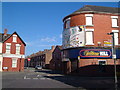
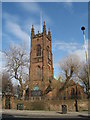

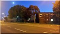
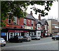
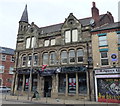
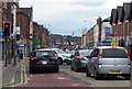
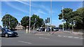
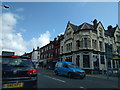
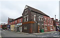
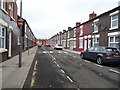
72 photos from this area
Area Information
Key information about the L20 9ND including its size, population, and administrative classification.
- Area Type
- Postcode
- Area Size
- 5858 m²
- Population
- 1596
- Population Density
- 5212 people/km²
House Prices in L20 9ND
35
Properties
£93,147
Average Sold Price
£30,000
Lowest Price
£150,000
Highest Price
Showing 35 properties
| Address | Type | Beds | Baths | Last Sale Price | Last Sale Date | |
|---|---|---|---|---|---|---|
| 253 Bedford Road, Bootle, L20 9ND | Terraced | 3 | 2 | £150,000 | Sep 2025 | |
| 229 Bedford Road, Bootle, L20 9ND | Terraced | 3 | 1 | £145,000 | Aug 2025 | |
| 241 Bedford Road, Bootle, L20 9ND | Terraced | 3 | - | £80,000 | Oct 2023 | |
| 249 Bedford Road, Bootle, L20 9ND | Terraced | 3 | 1 | £84,500 | Apr 2023 | |
| 259 Bedford Road, Bootle, L20 9ND | Retail | 3 | 1 | £132,500 | Dec 2022 | |
| 269 Bedford Road, Bootle, L20 9ND | Terraced | 3 | 1 | £101,000 | Sep 2022 | |
| 261 Bedford Road, Bootle, L20 9ND | house | - | - | £100,000 | Nov 2021 | |
| 219 Bedford Road, Bootle, L20 9ND | house | - | - | £133,000 | Sep 2021 | |
| 217 Bedford Road, Bootle, L20 9ND | house | 3 | 1 | £88,000 | May 2021 | |
| 239 Bedford Road, Bootle, L20 9ND | Terraced | 3 | 1 | £103,500 | Mar 2020 |
Page 1 of 4
Energy Efficiency in L20 9ND
Amenities
Schools
| Rank | School | Type | Entry gender | Ages |
|---|
Explore more schools in this area
Go to Schools tabDemographics
Household Size
One person
most common
Accommodation Type
Houses
most common
Tenure
45
majority
Ethnic Group
White
most common
Religion
N/A
most common
Household Composition
N/A
most common
Age
47
median
Adults (30-64 years)
most common
Household Deprivation
N/A
with no deprivation
NS-SEC
19
in Lower managerial occupations
Explore more demographic insights in this area
Go to Demographics tabPlanning
Planning Constraints
- Flood RiskPremium
- Ramsar Wetland SitesPremium
- Area of Outstanding Natural BeautyPremium
- Protected Nature ReservePremium
- Protected WoodlandPremium