Area Overview for L20 8TL
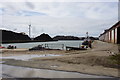
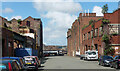
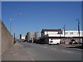
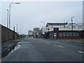
Photos of L20 8TL


Area Information
Living in L20 8TL means inhabiting a compact residential cluster in England, where 1.1 hectares of space house 1,840 people at a density of 843 per square kilometre. This small area is characterised by a mature community, with a median age of 47 and a majority of residents aged 30–64. The area is predominantly home to families and individuals seeking a settled environment, with 30% of properties owned by residents and the rest likely occupied by renters. Daily life here is shaped by proximity to essential services, including five railway stations within practical reach and multiple retail outlets. While the population is largely White, the community’s dynamics are influenced by its mix of housing types, primarily single-family homes. L20 8TL’s appeal lies in its balance of accessibility to transport networks and the presence of local amenities, though its small size means it is best suited for those prioritising convenience over expansive living spaces.
- Area Type
- Postcode
- Area Size
- 1.1 hectares
- Population
- 1840
- Population Density
- 843 people/km²
The property market in L20 8TL is defined by a 30% home ownership rate, suggesting that the majority of properties are occupied by renters. This contrasts with areas where owner-occupation is more prevalent, indicating a rental-heavy market. The accommodation type is primarily single-family houses, which are more common than flats or apartments. This mix of housing stock may appeal to families seeking space, though the small area size means the housing stock is limited. Buyers should consider the area’s compact nature, which may restrict options for larger properties. The presence of multiple railway stations nearby could enhance the area’s appeal for commuters, but the low home ownership rate suggests that investment opportunities may be more speculative.
House Prices in L20 8TL
Showing 2 properties
| Address | Type | Beds | Baths | Last Sale Price | Last Sale Date | |
|---|---|---|---|---|---|---|
| 33 Tyle Street, Liverpool, L20 8TL | Industrial | - | - | - | - | |
| 31 Tyle Street, Liverpool, L20 8TL | Industrial | - | - | - | - |
Energy Efficiency in L20 8TL
The lifestyle in L20 8TL is shaped by its proximity to essential amenities. Residents can access retail outlets like Lidl LIV, Sainsburys Liverpool Great, and Iceland County, ensuring everyday shopping needs are met. The area’s ferry terminals, including Liverpool Belfast Ferry Terminal Bootle and Seacombe Ferry Terminal, provide direct links to nearby destinations, enhancing connectivity. While the data does not mention parks or leisure facilities, the presence of multiple railway stations and retail hubs suggests a practical, convenience-focused lifestyle. The compact nature of the area means amenities are within walking or short driving distance, though the lack of detailed information on recreational spaces may require further investigation for those prioritising green spaces.
Amenities
Schools
Residents of L20 8TL have access to two primary schools: Our Lady of Reconciliation Catholic Primary School and Our Lady of Reconciliation RC Infant School. Both are Catholic institutions, catering to younger children and providing a faith-based educational environment. The presence of two primary schools within proximity offers families a choice, though no secondary schools are listed in the data. This suggests that parents may need to consider commuting for secondary education. The concentration of primary schools indicates that the area is well-suited for families with young children, though the lack of diversity in school types may limit options for those seeking alternative educational approaches.
| Rank | School | Type | Entry gender | Ages |
|---|
Explore more schools in this area
Go to Schools tabDemographics
The community in L20 8TL is predominantly composed of adults aged 30–64, with a median age of 47. This suggests a stable population with established careers and families. Home ownership is relatively low at 30%, indicating a significant proportion of residents rent their homes. The area is characterised by single-family houses, which dominate the accommodation type. The predominant ethnic group is White, though no data on diversity beyond this is provided. With a population density of 843 people per square kilometre, the area is moderately crowded, which may affect the availability of private outdoor space. The age profile suggests a community with a focus on long-term residency, though the lack of data on deprivation levels means it is unclear how economic factors influence quality of life.
Household Size
Accommodation Type
Tenure
Ethnic Group
Religion
Household Composition
Age
Household Deprivation
NS-SEC
Explore more demographic insights in this area
Go to Demographics tabPlanning
Planning Constraints
- Flood RiskPremium
- Ramsar Wetland SitesPremium
- Area of Outstanding Natural BeautyPremium
- Protected Nature ReservePremium
- Protected WoodlandPremium