Area Overview for L20 8EH
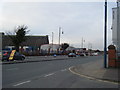
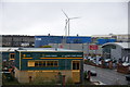
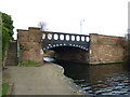
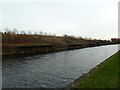
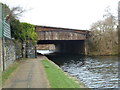
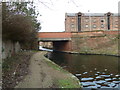
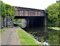
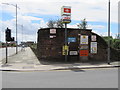
Photos of L20 8EH


Area Information
Living in L20 8EH means inhabiting a small, densely populated residential cluster in England. With a population of 1,840 and a density of 843 people per square kilometre, this area is compact yet functional. The community here skews towards adults aged 30–64, with a median age of 47, suggesting a mature demographic. This is not a young, rapidly growing area but one with established residents. The housing stock is predominantly houses, though only 30% are owner-occupied, indicating a significant rental market. For those seeking a quiet, close-knit environment, L20 8EH offers proximity to essential services. Nearby, Sandhills and Bank Hall railway stations provide connections to broader transport networks, while ferry terminals like Liverpool Belfast and Seacombe offer links to regional destinations. Schools such as Our Lady of Reconciliation Catholic Primary and Infant schools cater to local families. However, the area’s compact size means it is best suited for those prioritising convenience over expansive living spaces. While digital connectivity is strong, with broadband scoring 88 and mobile coverage 85, the crime risk is a notable concern, with a safety score of 32. For buyers, this area is ideal for those seeking a small, service-rich community with a mix of rental and owned properties.
- Area Type
- Postcode
- Area Size
- Not available
- Population
- 1840
- Population Density
- 843 people/km²
The property market in L20 8EH is characterised by a low home ownership rate of 30%, suggesting that the majority of housing stock is rented out rather than owned. The predominant accommodation type is houses, which is noteworthy for a small postcode area, often associated with higher-density housing. This mix may appeal to those seeking larger properties in a compact setting. However, the small size of the area limits the availability of properties, making it a niche market. For buyers, this means competition is likely to be fierce, with limited options for purchase. The rental market dominates, which may be advantageous for those seeking investment opportunities but less so for those prioritising ownership. The presence of houses rather than flats or apartments suggests a focus on family homes, though the low ownership rate implies that many of these properties are occupied by renters. Buyers should consider the area’s size and the dominance of rental properties when assessing long-term value.
House Prices in L20 8EH
No properties found in this postcode.
Energy Efficiency in L20 8EH
The lifestyle in L20 8EH is shaped by its proximity to essential amenities. Retail options include Lidl LIV, Spar Brewster, and Iceland County, providing access to groceries and everyday shopping. For transport, the area is well-connected by rail, with stations like Sandhills and Kirkdale offering links to broader networks. Ferry terminals such as Liverpool Belfast and Seacombe add regional connectivity, ideal for those needing travel to nearby islands or cities. While the area lacks large leisure facilities, the compact layout ensures that daily needs are met without long commutes. The presence of two primary schools and a mature demographic suggests a community focused on stability and practicality. However, the absence of secondary schools and larger parks means that residents may need to venture beyond the postcode for more extensive recreational or educational opportunities. The overall character of L20 8EH is one of convenience, with a balance of services and transport, though it is best suited for those prioritising accessibility over expansive amenities.
Amenities
Schools
The nearest schools to L20 8EH are Our Lady of Reconciliation Catholic Primary School and Our Lady of Reconciliation RC Infant School, both of which cater to primary education. These schools serve the local community, providing early years and primary education for children in the area. While the data does not specify Ofsted ratings, the presence of two Catholic schools suggests a focus on faith-based education. For families, this offers a clear option for primary schooling, though the absence of secondary schools nearby may require commuting. The concentration of primary schools indicates that the area is well-served for younger children, but parents of older students may need to look further afield. The proximity of these schools is a key consideration for buyers prioritising family-friendly living, though the lack of secondary education options is a practical limitation.
| Rank | School | Type | Entry gender | Ages |
|---|
Explore more schools in this area
Go to Schools tabDemographics
The population of L20 8EH is 1,840, with a density of 843 people per square kilometre, reflecting a tightly packed residential area. The median age is 47, and the most common age range is adults aged 30–64, indicating a mature community with limited presence of younger or older demographics. Home ownership here is low at 30%, suggesting that most residents rent their homes. The predominant accommodation type is houses, which is unusual for a small postcode area but may indicate a mix of family homes and larger properties. The predominant ethnic group is White, with no data provided on other groups. This demographic profile suggests a stable, established population with limited diversity. The low home ownership rate may impact long-term investment potential, while the age range implies a community with fewer young families or retirees. For buyers, this could mean a market skewed towards rental properties and a focus on properties suited to adult occupants rather than growing families.
Household Size
Accommodation Type
Tenure
Ethnic Group
Religion
Household Composition
Age
Household Deprivation
NS-SEC
Explore more demographic insights in this area
Go to Demographics tabPlanning
Planning Constraints
- Flood RiskPremium
- Ramsar Wetland SitesPremium
- Area of Outstanding Natural BeautyPremium
- Protected Nature ReservePremium
- Protected WoodlandPremium