Area Overview for L20 6HN
Photos of L20 6HN


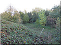
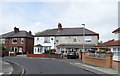
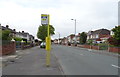


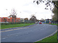
19 photos from this area
Area Information
Key information about the L20 6HN including its size, population, and administrative classification.
- Area Type
- Postcode
- Area Size
- 7708 m²
- Population
- 2149
- Population Density
- 3786 people/km²
House Prices in L20 6HN
28
Properties
£134,747
Average Sold Price
£27,000
Lowest Price
£177,500
Highest Price
Showing 28 properties
| Address | Type | Beds | Baths | Last Sale Price | Last Sale Date | |
|---|---|---|---|---|---|---|
| 53 Marmion Avenue, Bootle, L20 6HN | Semi-detached | 3 | 1 | £177,500 | Jun 2025 | |
| 13 Marmion Avenue, Bootle, L20 6HN | Semi-detached | 3 | 1 | £168,000 | Dec 2023 | |
| 51 Marmion Avenue, Bootle, L20 6HN | Terraced | 3 | 1 | £163,000 | Apr 2022 | |
| 49 Marmion Avenue, Bootle, L20 6HN | Semi-detached | 2 | 1 | £132,000 | Mar 2022 | |
| 23 Marmion Avenue, Bootle, L20 6HN | house | - | - | £131,000 | Jan 2022 | |
| 37 Marmion Avenue, Bootle, L20 6HN | Semi-detached | 3 | 2 | £138,000 | Jan 2020 | |
| 31 Marmion Avenue, Bootle, L20 6HN | Semi-detached | 3 | - | £122,000 | Feb 2018 | |
| 21 Marmion Avenue, Bootle, L20 6HN | Terraced | 3 | - | £125,000 | Jun 2016 | |
| 33 Marmion Avenue, Bootle, L20 6HN | Detached | 3 | 1 | £88,500 | Sep 2015 | |
| 41 Marmion Avenue, Bootle, L20 6HN | Semi-detached | 3 | 1 | £165,000 | Jan 2008 |
Page 1 of 3
Energy Efficiency in L20 6HN
Amenities
Schools
| Rank | School | Type | Entry gender | Ages |
|---|
Explore more schools in this area
Go to Schools tabDemographics
Household Size
Family (3-5 people)
most common
Accommodation Type
Houses
most common
Tenure
64
majority
Ethnic Group
White
most common
Religion
N/A
most common
Household Composition
N/A
most common
Age
47
median
Adults (30-64 years)
most common
Household Deprivation
N/A
with no deprivation
NS-SEC
28
in Lower managerial occupations
Explore more demographic insights in this area
Go to Demographics tabPlanning
Planning Constraints
- Flood RiskPremium
- Ramsar Wetland SitesPremium
- Area of Outstanding Natural BeautyPremium
- Protected Nature ReservePremium
- Protected WoodlandPremium