Area Overview for L20 6HF
Photos of L20 6HF
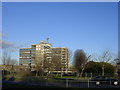
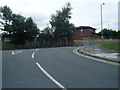

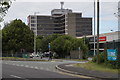

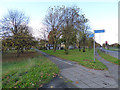

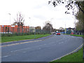
19 photos from this area
Area Information
Key information about the L20 6HF including its size, population, and administrative classification.
- Area Type
- Postcode
- Area Size
- 6038 m²
- Population
- 2149
- Population Density
- 3786 people/km²
House Prices in L20 6HF
18
Properties
£134,488
Average Sold Price
£95,000
Lowest Price
£179,950
Highest Price
Showing 18 properties
| Address | Type | Beds | Baths | Last Sale Price | Last Sale Date | |
|---|---|---|---|---|---|---|
| 41 Johnston Avenue, Bootle, L20 6HF | Semi-detached | 2 | 1 | £179,950 | Apr 2024 | |
| 35 Johnston Avenue, Bootle, L20 6HF | house | - | - | £130,000 | Jan 2021 | |
| 53 Johnston Avenue, Bootle, L20 6HF | Semi-detached | - | - | £133,000 | Sep 2020 | |
| 51 Johnston Avenue, Bootle, L20 6HF | house | - | - | £95,000 | Jul 2014 | |
| 59 Johnston Avenue, Bootle, L20 6HF | Detached | 3 | 1 | - | - | |
| 37 Johnston Avenue, Bootle, L20 6HF | house | - | - | - | - | |
| 63 Johnston Avenue, Bootle, L20 6HF | house | - | - | - | - | |
| 49 Johnston Avenue, Bootle, L20 6HF | Semi-detached | - | - | - | - | |
| 47 Johnston Avenue, Bootle, L20 6HF | house | - | - | - | - | |
| 57 Johnston Avenue, Bootle, L20 6HF | house | - | - | - | - |
Page 1 of 2
Energy Efficiency in L20 6HF
Amenities
Schools
| Rank | School | Type | Entry gender | Ages |
|---|
Explore more schools in this area
Go to Schools tabDemographics
Household Size
Family (3-5 people)
most common
Accommodation Type
Houses
most common
Tenure
64
majority
Ethnic Group
White
most common
Religion
N/A
most common
Household Composition
N/A
most common
Age
47
median
Adults (30-64 years)
most common
Household Deprivation
N/A
with no deprivation
NS-SEC
28
in Lower managerial occupations
Explore more demographic insights in this area
Go to Demographics tabPlanning
Planning Constraints
- Flood RiskPremium
- Ramsar Wetland SitesPremium
- Area of Outstanding Natural BeautyPremium
- Protected Nature ReservePremium
- Protected WoodlandPremium