Area Overview for L20 4NS
Photos of L20 4NS


Area Information
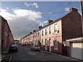
Living in L20 4NS offers a compact, residential experience shaped by its small cluster of homes and proximity to essential services. With a population of 1,209, the area is tight-knit, catering to a community where adults aged 30–64 form the majority. Daily life here is defined by practicality, with easy access to retail, rail, and ferry networks. The postcode’s proximity to Liverpool’s waterfront and transport hubs makes it appealing for commuters, while the excellent broadband connectivity supports remote work. Though modest in size, L20 4NS balances suburban comfort with urban accessibility, offering a snapshot of northern England’s evolving housing landscape. Its low flood risk and absence of environmental constraints mean residents can focus on the straightforward challenges of a small, mature community rather than navigating complex planning restrictions.
- Area Type
- Postcode
- Area Size
- Not available
- Population
- 1209
- Population Density
- 9649 people/km²
The property market in L20 4NS is characterised by a low home ownership rate of 29%, indicating that a significant portion of the housing stock is rented. The area is primarily composed of houses, which are less common in urban centres but typical for smaller residential clusters. This suggests a market where owner-occupiers are a minority, and rental demand may be higher. For buyers, the small size of the area means opportunities are limited to existing properties rather than new builds. The presence of houses rather than flats implies a focus on family-sized homes, though the low ownership rate could signal a reliance on private landlords. Prospective buyers should consider the limited inventory and the potential for competition in a niche market.
House Prices in L20 4NS
No properties found in this postcode.
Energy Efficiency in L20 4NS
Life in L20 4NS is shaped by its proximity to retail, transport, and waterfront amenities. The area is within reach of five notable shops, including Lidl Wellington, Aldi Bootle, and Asda Bootle, offering everyday essentials. Rail services are frequent, with stations like Bootle Oriel Road and Bootle New Strand providing links to Liverpool and beyond. Ferry terminals such as Seacombe Ferry Terminal and Liverpool Isle of Man & Dublin Terminal add flexibility for travel, particularly for those reliant on waterways. While the area lacks large parks or leisure hubs, its practical layout ensures residents can access shopping, transport, and regional connections without long commutes. The mix of retail and transport options supports a functional lifestyle, though those seeking expansive recreational spaces may need to look further afield.
Amenities
Schools
| Rank | School | Type | Entry gender | Ages |
|---|
Explore more schools in this area
Go to Schools tabDemographics
The community in L20 4NS is predominantly composed of adults aged 30–64, with a median age of 47. Home ownership here is relatively low at 29%, suggesting a mix of renters and owner-occupiers. The area is largely made up of houses, reflecting a traditional housing stock rather than flats or apartments. The predominant ethnic group is White, which aligns with broader trends in northern England. While no specific data on deprivation is provided, the age profile and ownership figures indicate a mature, settled population. This demographic likely prioritises stability over expansion, with limited new development in the area. The absence of detailed diversity metrics means the community’s full composition remains partially opaque, but the figures suggest a homogeneous, middle-aged core.
Household Size
Accommodation Type
Tenure
Ethnic Group
Religion
Household Composition
Age
Household Deprivation
NS-SEC
Explore more demographic insights in this area
Go to Demographics tabPlanning
Planning Constraints
- Flood RiskPremium
- Ramsar Wetland SitesPremium
- Area of Outstanding Natural BeautyPremium
- Protected Nature ReservePremium
- Protected WoodlandPremium