Area Overview for L20 4EH
Photos of L20 4EH
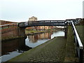
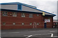
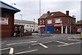
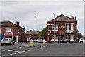


62 photos from this area
Area Information
Key information about the L20 4EH including its size, population, and administrative classification.
- Area Type
- Postcode
- Area Size
- 4355 m²
- Population
- 1320
- Population Density
- 2998 people/km²
House Prices in L20 4EH
15
Properties
£72,278
Average Sold Price
£25,995
Lowest Price
£150,000
Highest Price
Showing 15 properties
| Address | Type | Beds | Baths | Last Sale Price | Last Sale Date | |
|---|---|---|---|---|---|---|
| 164 Irlam Road, Bootle, L20 4EH | Semi-detached | 3 | 1 | £150,000 | May 2024 | |
| 170 Irlam Road, Bootle, L20 4EH | Semi-detached | 3 | 1 | £110,000 | Oct 2021 | |
| 160 Irlam Road, Bootle, L20 4EH | house | - | - | £82,450 | Jun 2010 | |
| 152 Irlam Road, Bootle, L20 4EH | Terraced | 2 | - | £63,500 | Jul 2006 | |
| 162 Irlam Road, Bootle, L20 4EH | Semi-detached | - | - | £37,000 | Apr 2001 | |
| 168 Irlam Road, Bootle, L20 4EH | Semi-detached | - | - | £25,995 | Jun 1999 | |
| 172 Irlam Road, Bootle, L20 4EH | house | - | - | £37,000 | Mar 1996 | |
| 146 Irlam Road, Bootle, L20 4EH | Semi-detached | 3 | 1 | - | - | |
| 156 Irlam Road, Bootle, L20 4EH | house | - | - | - | - | |
| 148 Irlam Road, Bootle, L20 4EH | Terraced | - | - | - | - |
Page 1 of 2
Energy Efficiency in L20 4EH
Amenities
Schools
| Rank | School | Type | Entry gender | Ages |
|---|
Explore more schools in this area
Go to Schools tabDemographics
Household Size
One person
most common
Accommodation Type
Houses
most common
Tenure
28
majority
Ethnic Group
White
most common
Religion
N/A
most common
Household Composition
N/A
most common
Age
47
median
Adults (30-64 years)
most common
Household Deprivation
N/A
with no deprivation
NS-SEC
12
in Lower managerial occupations
Explore more demographic insights in this area
Go to Demographics tabPlanning
Planning Constraints
- Flood RiskPremium
- Ramsar Wetland SitesPremium
- Area of Outstanding Natural BeautyPremium
- Protected Nature ReservePremium
- Protected WoodlandPremium