Area Overview for L20 3HE
Photos of L20 3HE

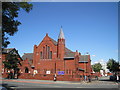
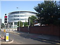

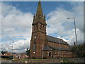
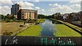


96 photos from this area
Area Information
Key information about the L20 3HE including its size, population, and administrative classification.
- Area Type
- Postcode
- Area Size
- 3065 m²
- Population
- 1652
- Population Density
- 7303 people/km²
House Prices in L20 3HE
21
Properties
£51,337
Average Sold Price
£16,500
Lowest Price
£96,000
Highest Price
Showing 21 properties
| Address | Type | Beds | Baths | Last Sale Price | Last Sale Date | |
|---|---|---|---|---|---|---|
| 35 Cedar Street, Bootle, L20 3HE | Terraced | 3 | 1 | £96,000 | Apr 2024 | |
| 47 Cedar Street, Bootle, L20 3HE | Terraced | 2 | 1 | £87,000 | Feb 2023 | |
| 55 Cedar Street, Bootle, L20 3HE | Terraced | 2 | 1 | £84,000 | Nov 2022 | |
| 43 Cedar Street, Bootle, L20 3HE | Terraced | 2 | 1 | £39,000 | Feb 2018 | |
| 69 Cedar Street, Bootle, L20 3HE | Terraced | 2 | 1 | £60,000 | May 2015 | |
| 33 Cedar Street, Bootle, L20 3HE | house | 3 | 1 | £63,712 | Apr 2008 | |
| 49 Cedar Street, Bootle, L20 3HE | Terraced | - | - | £39,500 | Jan 2004 | |
| 29 Cedar Street, Bootle, L20 3HE | house | - | - | £21,000 | Apr 2003 | |
| 53 Cedar Street, Bootle, L20 3HE | house | - | - | £26,500 | Jan 2003 | |
| 37 Cedar Street, Bootle, L20 3HE | Terraced | - | - | £31,500 | Oct 1997 |
Page 1 of 3
Energy Efficiency in L20 3HE
Amenities
Schools
| Rank | School | Type | Entry gender | Ages |
|---|
Explore more schools in this area
Go to Schools tabDemographics
Household Size
One person
most common
Accommodation Type
Houses
most common
Tenure
40
majority
Ethnic Group
White
most common
Religion
N/A
most common
Household Composition
N/A
most common
Age
47
median
Adults (30-64 years)
most common
Household Deprivation
N/A
with no deprivation
NS-SEC
14
in Lower managerial occupations
Explore more demographic insights in this area
Go to Demographics tabPlanning
Planning Constraints
- Flood RiskPremium
- Ramsar Wetland SitesPremium
- Area of Outstanding Natural BeautyPremium
- Protected Nature ReservePremium
- Protected WoodlandPremium