Area Overview for L2 9XN
Photos of L2 9XN


Area Information
Living in L2 9XN means being part of a small, tightly knit residential cluster in England, home to just 1,119 people. This postcode area is characterised by its compact size and proximity to essential services, making it practical for those prioritising convenience. The community is young, with a median age of 22 and most residents falling within the 15–29 age range. Daily life here is shaped by the availability of nearby retail, transport, and ferry links, which connect the area to broader networks. While the population is modest, the presence of five retail outlets—including Sainsburys Liverpool and Tesco Liverpool—ensures basic needs are met locally. The area’s small footprint means it is not sprawling, but its access to rail stations like Liverpool James Street and ferry terminals such as Liverpool Pier Head adds to its connectivity. For those seeking a balance between urban access and a compact living space, L2 9XN offers a distinct blend of practicality and proximity to larger cities. However, the community’s youth and rental-oriented nature mean it is less suited to long-term family living than other areas.
- Area Type
- Postcode
- Area Size
- Not available
- Population
- 1119
- Population Density
- 6159 people/km²
The property market in L2 9XN is heavily rental-focused, with only 15% of residents owning their homes. This suggests a housing stock that is largely let out to tenants, particularly students or young professionals seeking short-term accommodation. The predominant accommodation type is flats, which aligns with the area’s compact nature and the needs of a transient population. For buyers, this means limited opportunities to purchase owner-occupied properties within the postcode itself. The small size of the area further restricts the availability of homes, making it more of a satellite zone for larger cities rather than a standalone market. Prospective buyers should consider that any property in L2 9XN is likely to be part of a larger estate or development, with limited scope for expansion or renovation. The rental demand may also drive up prices for flats, making ownership less feasible for those seeking long-term investment.
House Prices in L2 9XN
No properties found in this postcode.
Energy Efficiency in L2 9XN
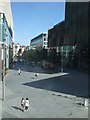
Residents of L2 9XN have access to a range of nearby amenities, including five retail outlets such as Sainsburys Liverpool, Tesco Liverpool, and M&S Liverpool. These shops provide essential services and convenience for daily errands. The area’s transport links are equally strong, with rail stations like Liverpool Central Loop Line and ferry terminals such as Liverpool Pier Head offering easy access to broader networks. While the area lacks large parks or leisure facilities, its proximity to Liverpool ensures that residents can quickly reach cultural and recreational spaces. The practical reach of amenities means that daily life is efficient, with minimal need to travel far for shopping, dining, or transport. However, the small size of L2 9XN means that the community itself is limited in scale, relying heavily on nearby cities for more extensive lifestyle options.
Amenities
Schools
| Rank | School | Type | Entry gender | Ages |
|---|
Explore more schools in this area
Go to Schools tabDemographics
The community in L2 9XN is overwhelmingly young, with a median age of 22 and the majority of residents aged between 15 and 29. This demographic profile suggests a population focused on early career development, education, or transitional living. Home ownership is exceptionally low at 15%, indicating that most residents are renters rather than property owners. The accommodation type is predominantly flats, reflecting a housing stock tailored to single occupants or small households. The predominant ethnic group is White, though the data does not specify further diversity metrics. The low home ownership rate and young age profile imply a transient community, with residents potentially moving frequently. This dynamic may influence the area’s social fabric, creating a fast-paced environment where long-term relationships or community ties are less common. The combination of rental-focused housing and a youthful population also means that amenities and services must cater to temporary residents rather than established families.
Household Size
Accommodation Type
Tenure
Ethnic Group
Religion
Household Composition
Age
Household Deprivation
NS-SEC
Explore more demographic insights in this area
Go to Demographics tabPlanning
Planning Constraints
- Flood RiskPremium
- Ramsar Wetland SitesPremium
- Area of Outstanding Natural BeautyPremium
- Protected Nature ReservePremium
- Protected WoodlandPremium