Area Overview for L2 4XE
Photos of L2 4XE


Area Information
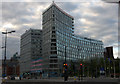
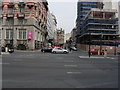
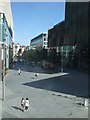
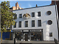
Living in L2 4XE means being part of a small, tightly knit residential cluster in England, where the population of 1,029 residents creates a compact, manageable community. This postcode area is defined by its proximity to key urban hubs, with easy access to Liverpool’s transport networks and retail centres. The area’s character is shaped by its modest size and the prevalence of flats, reflecting a mix of rental properties and smaller households. Daily life here is influenced by the surrounding infrastructure, including nearby rail lines and ferry terminals, which connect residents to broader regional opportunities. While the area lacks natural landscapes or protected sites, its strategic location near major transport arteries and retail hubs offers practical convenience. For those seeking a low-maintenance lifestyle with access to urban amenities, L2 4XE provides a straightforward, no-frills environment. However, the high crime risk reported in the area means residents should consider security measures as part of their living arrangements.
- Area Type
- Postcode
- Area Size
- Not available
- Population
- 1029
- Population Density
- 5049 people/km²
The property market in L2 4XE is largely rental-focused, with only 23% of residents owning their homes. The area is defined by flats, which make up the majority of accommodation types. This suggests a housing stock tailored to smaller households, students, or those seeking affordable, short-term living solutions. Given the small population and limited number of properties, the market is unlikely to offer a wide range of options for buyers. For those considering purchasing, the area may appeal to investors seeking rental income or first-time buyers looking for entry-level properties. However, the dominance of flats and low ownership rates indicate that the area is not ideal for those seeking larger homes or long-term equity growth. Buyers should also factor in the local safety profile when assessing property value.
House Prices in L2 4XE
No properties found in this postcode.
Energy Efficiency in L2 4XE
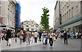
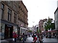
Residents of L2 4XE have access to a range of practical amenities within reach, including five retail outlets such as Sainsburys Liverpool, Tesco Liverpool, and M&S Liverpool. These stores provide everyday shopping convenience, from groceries to clothing. The area’s rail network, with stations like Liverpool Central Loop Line and Moorfields, connects residents to broader urban and regional services. Ferry terminals such as Liverpool Isle of Man & Dublin Terminal and Seacombe offer transport options for both leisure and commuting. While the area lacks large parks or cultural landmarks, its proximity to transport hubs and retail centres supports a lifestyle focused on accessibility rather than leisure. The presence of multiple rail and ferry options also means residents can quickly reach destinations beyond the immediate postcode, enhancing the area’s practical appeal.
Amenities
Schools
| Rank | School | Type | Entry gender | Ages |
|---|
Explore more schools in this area
Go to Schools tabDemographics
The community in L2 4XE is predominantly young, with a median age of 22 and the majority of residents falling within the 15–29 age range. This demographic profile suggests a population skewed toward students, young professionals, or those starting their careers. Home ownership is relatively low at 23%, indicating that most residents rent their accommodation. The area is characterised by flats, which dominate the housing stock, reflecting a trend towards smaller, shared living spaces. The predominant ethnic group is White, though no specific data on diversity beyond this is provided. The low home ownership rate and young age profile suggest a transient population, with residents potentially moving frequently for work or education. This dynamic may influence the local social fabric, creating a community that is fluid rather than long-established.
Household Size
Accommodation Type
Tenure
Ethnic Group
Religion
Household Composition
Age
Household Deprivation
NS-SEC
Explore more demographic insights in this area
Go to Demographics tabPlanning
Planning Constraints
- Flood RiskPremium
- Ramsar Wetland SitesPremium
- Area of Outstanding Natural BeautyPremium
- Protected Nature ReservePremium
- Protected WoodlandPremium