Area Overview for L19 8JZ
Photos of L19 8JZ

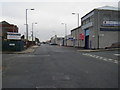

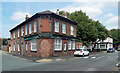
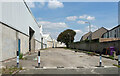
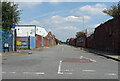


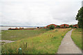
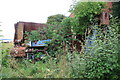
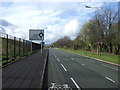
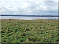
31 photos from this area
Area Information
Key information about the L19 8JZ including its size, population, and administrative classification.
- Area Type
- Postcode
- Area Size
- 3.4 hectares
- Population
- 1402
- Population Density
- 8834 people/km²
House Prices in L19 8JZ
16
Properties
£118,100
Average Sold Price
£61,000
Lowest Price
£170,000
Highest Price
Showing 16 properties
| Address | Type | Beds | Baths | Last Sale Price | Last Sale Date | |
|---|---|---|---|---|---|---|
| 82 Banks Road, Liverpool, L19 8JZ | house | - | - | £61,000 | Mar 2017 | |
| 104 Banks Road, Liverpool, L19 8JZ | house | 3 | 1 | £110,000 | Nov 2014 | |
| 88 Banks Road, Liverpool, L19 8JZ | house | - | - | £170,000 | Nov 2013 | |
| 102 Banks Road, Liverpool, L19 8JZ | house | - | - | £110,000 | Sep 2009 | |
| 94 Banks Road, Liverpool, L19 8JZ | Terraced | - | - | £139,500 | Dec 2006 | |
| 84 Banks Road, Liverpool, L19 8JZ | Terraced | 2 | 1 | - | - | |
| 80 Banks Road, Liverpool, L19 8JZ | Semi-detached | 2 | - | - | - | |
| 92 Banks Road, Liverpool, L19 8JZ | Semi-detached | 2 | - | - | - | |
| Garston Nhs Treatment Centre, 72 Banks Road, Liverpool, L19 8JZ | commercial | - | - | - | - | |
| 86 Banks Road, Liverpool, L19 8JZ | house | - | - | - | - |
Page 1 of 2
Energy Efficiency in L19 8JZ
Amenities
Schools
| Rank | School | Type | Entry gender | Ages |
|---|
Explore more schools in this area
Go to Schools tabDemographics
Household Size
One person
most common
Accommodation Type
Houses
most common
Tenure
43
majority
Ethnic Group
White
most common
Religion
N/A
most common
Household Composition
N/A
most common
Age
47
median
Adults (30-64 years)
most common
Household Deprivation
N/A
with no deprivation
NS-SEC
14
in Lower managerial occupations
Explore more demographic insights in this area
Go to Demographics tabPlanning
Planning Constraints
- Flood RiskPremium
- Ramsar Wetland SitesPremium
- Area of Outstanding Natural BeautyPremium
- Protected Nature ReservePremium
- Protected WoodlandPremium