Area Overview for L19 4YW
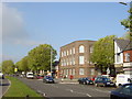
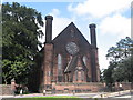
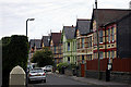
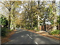
Photos of L19 4YW


Area Information
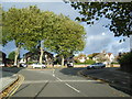
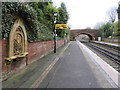
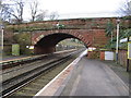
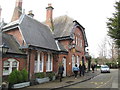
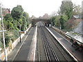
Living in L19 4YW means being part of a small, tightly knit residential cluster in England. With a population of 1,591, this area is compact yet functional, offering a mix of everyday conveniences without the density of larger urban centres. The community is characterised by a median age of 47, with most residents falling into the 30-64 age range. This suggests a stable demographic, likely comprising working-age adults and families. The area’s proximity to multiple rail stations, including Cressington and Liverpool South Parkway, ensures easy access to regional travel. Nearby, Liverpool John Lennon Airport and several ferry terminals provide connections to both domestic and international destinations. The presence of both state and independent schools, such as Gilmour Junior School and Clarendon College, indicates a focus on education, appealing to families. Daily life here balances practicality with accessibility, with local amenities like Aldi, Asda, and Lidl within walking distance. While the area is small, its infrastructure and services are well-tailored to meet the needs of its residents.
- Area Type
- Postcode
- Area Size
- Not available
- Population
- 1591
- Population Density
- 6341 people/km²
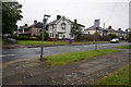
The property market in L19 4YW is dominated by owner-occupied homes, with 63% of properties owned by their residents. The accommodation type is primarily houses, which suggests a preference for single-family dwellings over flats or apartments. This composition indicates a market that caters to families and individuals seeking more space and privacy. Given the small size of the area, the housing stock is likely limited in volume, which could mean higher competition for available properties. The high home ownership rate implies a stable market with fewer rental properties, potentially making it challenging for buyers seeking investment opportunities. For those considering purchase, the focus on houses means properties may be larger and more suited to long-term occupancy rather than short-term rental. The area’s proximity to transport links and amenities may also enhance its appeal to buyers prioritising convenience.
House Prices in L19 4YW
No properties found in this postcode.
Energy Efficiency in L19 4YW
Residents of L19 4YW enjoy a range of amenities within practical reach. Local retail options include Aldi Garston, Asda Garston, and Lidl Garston – St Mary’s, providing everyday shopping convenience. The area’s rail stations, such as Cressington and West Allerton, connect to broader networks, while nearby airports and ferry terminals offer travel to destinations across the UK and beyond. Although the data does not mention parks or leisure facilities, the presence of multiple transport hubs and retail outlets suggests a focus on accessibility over expansive recreational spaces. The mix of retail, transport, and travel options ensures daily life is efficient, with minimal need to travel far for essentials. This practicality, combined with the area’s compact size, creates a lifestyle that prioritises convenience without sacrificing connectivity.
Amenities
Schools
Residents of L19 4YW have access to a range of educational institutions, including Gilmour Junior School, a primary school, and Clarendon College, an independent secondary institution. Gilmour Junior School serves younger children, providing a foundation for early education, while Clarendon College offers a more specialised, fee-based education. The mix of state and independent schools reflects a diversity of options for families, from publicly funded education to private alternatives. This variety allows parents to choose between free, publicly accessible schooling or the structured environment of an independent college. The presence of both types of schools suggests the area caters to a broad spectrum of educational needs and preferences, ensuring families can find options that align with their values and financial circumstances.
| Rank | School | Type | Entry gender | Ages |
|---|
Explore more schools in this area
Go to Schools tabDemographics
The community in L19 4YW is predominantly composed of adults aged 30-64, with a median age of 47. This suggests a mature, established population, likely with long-term ties to the area. Home ownership is high, at 63%, indicating a strong presence of owner-occupied properties. The accommodation type is primarily houses, which aligns with the area’s residential character. The predominant ethnic group is White, reflecting a homogenous demographic profile. While no specific data on deprivation is provided, the high home ownership rate and stable age distribution suggest a relatively secure economic environment. This stability may contribute to a sense of continuity and community cohesion. The absence of detailed diversity statistics means the area’s social composition remains largely defined by its majority White population.
Household Size
Accommodation Type
Tenure
Ethnic Group
Religion
Household Composition
Age
Household Deprivation
NS-SEC
Explore more demographic insights in this area
Go to Demographics tabPlanning
Planning Constraints
- Flood RiskPremium
- Ramsar Wetland SitesPremium
- Area of Outstanding Natural BeautyPremium
- Protected Nature ReservePremium
- Protected WoodlandPremium