Area Overview for L19 4UX
Photos of L19 4UX


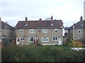
25 photos from this area
Area Information
Key information about the L19 4UX including its size, population, and administrative classification.
- Area Type
- Postcode
- Area Size
- 1.1 hectares
- Population
- 1816
- Population Density
- 2731 people/km²
House Prices in L19 4UX
38
Properties
£119,750
Average Sold Price
£27,000
Lowest Price
£235,000
Highest Price
Showing 38 properties
| Address | Type | Beds | Baths | Last Sale Price | Last Sale Date | |
|---|---|---|---|---|---|---|
| 70 Caldwell Road, Liverpool, L19 4UX | Terraced | 3 | 1 | £235,000 | Mar 2025 | |
| 50 Caldwell Road, Liverpool, L19 4UX | house | 3 | 1 | £195,000 | Mar 2022 | |
| 12 Caldwell Road, Liverpool, L19 4UX | house | - | - | £185,000 | Dec 2021 | |
| 72 Caldwell Road, Liverpool, L19 4UX | house | - | - | £208,000 | Oct 2021 | |
| 30 Caldwell Road, Liverpool, L19 4UX | Semi-detached | 3 | 1 | £202,500 | Apr 2021 | |
| 66 Caldwell Road, Liverpool, L19 4UX | Terraced | 3 | - | £120,000 | Jan 2016 | |
| 2 Caldwell Road, Liverpool, L19 4UX | Semi-detached | 5 | 1 | £135,000 | Dec 2015 | |
| 62 Caldwell Road, Liverpool, L19 4UX | Semi-detached | 3 | - | £110,000 | Mar 2015 | |
| 52 Caldwell Road, Liverpool, L19 4UX | house | - | - | £137,500 | May 2013 | |
| 18 Caldwell Road, Liverpool, L19 4UX | house | - | - | £100,000 | Mar 2008 |
Page 1 of 4
Energy Efficiency in L19 4UX
Amenities
Schools
| Rank | School | Type | Entry gender | Ages |
|---|
Explore more schools in this area
Go to Schools tabDemographics
Household Size
Family (3-5 people)
most common
Accommodation Type
Houses
most common
Tenure
62
majority
Ethnic Group
White
most common
Religion
N/A
most common
Household Composition
N/A
most common
Age
47
median
Adults (30-64 years)
most common
Household Deprivation
N/A
with no deprivation
NS-SEC
23
in Lower managerial occupations
Explore more demographic insights in this area
Go to Demographics tabPlanning
Planning Constraints
- Flood RiskPremium
- Ramsar Wetland SitesPremium
- Area of Outstanding Natural BeautyPremium
- Protected Nature ReservePremium
- Protected WoodlandPremium