Area Overview for L19 4UR
Photos of L19 4UR

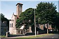
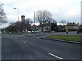
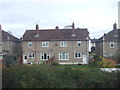
25 photos from this area
Area Information
Key information about the L19 4UR including its size, population, and administrative classification.
- Area Type
- Postcode
- Area Size
- 9291 m²
- Population
- 1890
- Population Density
- 5881 people/km²
House Prices in L19 4UR
32
Properties
£131,743
Average Sold Price
£34,950
Lowest Price
£255,000
Highest Price
Showing 32 properties
| Address | Type | Beds | Baths | Last Sale Price | Last Sale Date | |
|---|---|---|---|---|---|---|
| 1 Verney Crescent, Liverpool, L19 4UR | Semi-detached | 3 | 1 | £240,000 | Jun 2025 | |
| 59 Verney Crescent, Liverpool, L19 4UR | house | - | - | £190,000 | Mar 2025 | |
| 55 Verney Crescent, Liverpool, L19 4UR | house | - | - | £90,000 | Sep 2024 | |
| 13 Verney Crescent, Liverpool, L19 4UR | Semi-detached | 3 | 1 | £255,000 | Nov 2023 | |
| 5 Verney Crescent, Liverpool, L19 4UR | house | 3 | 1 | £233,000 | Aug 2023 | |
| 19 Verney Crescent, Liverpool, L19 4UR | Semi-detached | 3 | 1 | £152,000 | Jan 2019 | |
| 57 Verney Crescent, Liverpool, L19 4UR | house | - | - | £149,950 | Mar 2018 | |
| 45 Verney Crescent, Liverpool, L19 4UR | Semi-detached | 3 | 1 | £125,000 | Nov 2015 | |
| 53 Verney Crescent, Liverpool, L19 4UR | Semi-detached | 3 | - | £103,500 | Aug 2011 | |
| 51 Verney Crescent, Liverpool, L19 4UR | Semi-detached | - | - | £140,000 | Nov 2007 |
Page 1 of 4
Energy Efficiency in L19 4UR
Amenities
Schools
| Rank | School | Type | Entry gender | Ages |
|---|
Explore more schools in this area
Go to Schools tabDemographics
Household Size
Family (3-5 people)
most common
Accommodation Type
Houses
most common
Tenure
72
majority
Ethnic Group
White
most common
Religion
N/A
most common
Household Composition
N/A
most common
Age
47
median
Adults (30-64 years)
most common
Household Deprivation
N/A
with no deprivation
NS-SEC
39
in Lower managerial occupations
Explore more demographic insights in this area
Go to Demographics tabPlanning
Planning Constraints
- Flood RiskPremium
- Ramsar Wetland SitesPremium
- Area of Outstanding Natural BeautyPremium
- Protected Nature ReservePremium
- Protected WoodlandPremium