Area Overview for L19 3QR
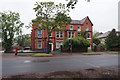
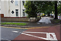
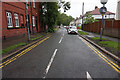
Photos of L19 3QR


Area Information
Living in L19 3QR offers a compact, residential experience within a small cluster of homes in England. With a population of 2178, the area is characterised by a quiet, mature community. The median age of 47 suggests a stable demographic, with adults aged 30–64 forming the largest group. This suggests a neighbourhood where many residents are established in their careers and family life. The area’s proximity to multiple rail stations, retail outlets, and ferry terminals ensures practical connectivity without the hustle of larger cities. While the housing stock is predominantly composed of houses, the small size of the postcode means the community feels close-knit. Residents benefit from low crime risk and minimal environmental constraints, making it a place where daily life can unfold with relative ease. The presence of nearby amenities, including schools and transport links, adds to its appeal for those seeking a balanced lifestyle. L19 3QR is not a sprawling suburb but a defined, manageable area where convenience and tranquillity coexist.
- Area Type
- Postcode
- Area Size
- Not available
- Population
- 2178
- Population Density
- 3466 people/km²
The property market in L19 3QR is dominated by owner-occupied homes, with 73% of residents living in properties they own. This suggests a stable, long-term market rather than a rental-heavy area. The accommodation type is primarily houses, which may reflect the area’s suburban or semi-rural character. Given the small size of the postcode, the housing stock is likely limited, meaning buyers should consider the immediate surrounding areas for more options. The high home ownership rate indicates that properties here may appreciate in value over time, though the data does not provide specific price trends. For buyers, this means a focus on quality and location rather than volume. The lack of large-scale development or commercial properties also suggests a low-density, residential environment. Those seeking a home in L19 3QR should prioritise proximity to essential services, as the area’s compact nature means amenities are not extensive.
House Prices in L19 3QR
No properties found in this postcode.
Energy Efficiency in L19 3QR
Daily life in L19 3QR is shaped by its proximity to a mix of retail, transport, and travel options. The area is within walking or short driving distance of shops such as Tesco Holmefield and Aldi Garston, offering convenience for grocery shopping. The five rail stations, including Cressington and West Allerton, provide easy access to regional destinations, while ferry terminals like Woodside Birkenhead and Liverpool Pier Head connect to nearby towns and islands. The presence of Liverpool John Lennon Airport ensures international travel is within reach. For leisure, the area’s small size means amenities are not extensive, but the available options contribute to a practical lifestyle. Residents can enjoy a balance of local services and broader connectivity, making it suitable for those who value accessibility without the noise of a larger urban centre.
Amenities
Schools
The nearest school to L19 3QR is South Mersey College, which is categorised as an "other" institution. No specific Ofsted rating is provided, so its educational quality remains unquantified in this data. The absence of primary or secondary schools listed means families may need to look beyond the immediate area for schools catering to younger children. This could be a consideration for prospective buyers prioritising proximity to education. The single listed institution suggests a limited range of educational options, which may require additional commuting for students. While the data does not include details on school performance or capacity, the presence of any educational facility is a positive for the area. However, the lack of multiple schools highlights a potential gap in local infrastructure for families with children.
| Rank | School | Type | Entry gender | Ages |
|---|
Explore more schools in this area
Go to Schools tabDemographics
The community in L19 3QR is predominantly composed of adults aged 30–64, with a median age of 47. This suggests a mature population, likely with long-term ties to the area. Home ownership is high, with 73% of residents living in owner-occupied properties, indicating a stable housing market. The accommodation type is primarily houses, which aligns with the area’s residential character. The predominant ethnic group is White, though specific data on diversity or deprivation is not provided. The absence of detailed diversity statistics means the community’s composition remains largely unexplored in this context. The age profile suggests a population that is neither young nor elderly, which may influence local services and amenities. For instance, schools and healthcare facilities are likely tailored to adult needs rather than those of children or older residents. The high home ownership rate also implies a lower turnover of residents, contributing to a sense of continuity in the neighbourhood.
Household Size
Accommodation Type
Tenure
Ethnic Group
Religion
Household Composition
Age
Household Deprivation
NS-SEC
Explore more demographic insights in this area
Go to Demographics tabPlanning
Planning Constraints
- Flood RiskPremium
- Ramsar Wetland SitesPremium
- Area of Outstanding Natural BeautyPremium
- Protected Nature ReservePremium
- Protected WoodlandPremium