Area Overview for L19 3QE
Photos of L19 3QE
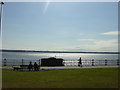

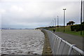

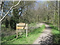

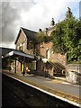
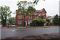
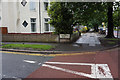
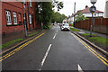


47 photos from this area
Area Information
Key information about the L19 3QE including its size, population, and administrative classification.
- Area Type
- Postcode
- Area Size
- 1.3 hectares
- Population
- 2178
- Population Density
- 3466 people/km²
House Prices in L19 3QE
27
Properties
£336,179
Average Sold Price
£170,000
Lowest Price
£450,000
Highest Price
Showing 27 properties
| Address | Type | Beds | Baths | Last Sale Price | Last Sale Date | |
|---|---|---|---|---|---|---|
| 464 Aigburth Road, Cressington, Liverpool, L19 3QE | Semi-detached | 3 | 1 | £405,000 | Jun 2021 | |
| 458 Aigburth Road, Cressington, Liverpool, L19 3QE | house | - | - | £450,000 | May 2021 | |
| 456 Aigburth Road, Cressington, Liverpool, L19 3QE | Semi-detached | 3 | 2 | £369,500 | Feb 2020 | |
| 444 Aigburth Road, Cressington, Liverpool, L19 3QE | Detached | 5 | - | £400,000 | Dec 2019 | |
| 474 Aigburth Road, Cressington, Liverpool, L19 3QE | Detached | 3 | 2 | £420,000 | Aug 2019 | |
| 446 Aigburth Road, Cressington, Liverpool, L19 3QE | Semi-detached | 4 | 1 | £280,000 | Apr 2019 | |
| 452 Aigburth Road, Cressington, Liverpool, L19 3QE | Semi-detached | 4 | - | £318,000 | Mar 2018 | |
| 440 Aigburth Road, Cressington, Liverpool, L19 3QE | Detached | 4 | 1 | £310,000 | Apr 2017 | |
| 448 Aigburth Road, Cressington, Liverpool, L19 3QE | Semi-detached | 4 | - | £337,000 | Nov 2015 | |
| 468 Aigburth Road, Cressington, Liverpool, L19 3QE | Detached | 5 | 2 | £370,000 | May 2015 |
Page 1 of 3
Energy Efficiency in L19 3QE
Amenities
Schools
| Rank | School | Type | Entry gender | Ages |
|---|
Explore more schools in this area
Go to Schools tabDemographics
Household Size
Two person
most common
Accommodation Type
Houses
most common
Tenure
73
majority
Ethnic Group
White
most common
Religion
N/A
most common
Household Composition
N/A
most common
Age
47
median
Adults (30-64 years)
most common
Household Deprivation
N/A
with no deprivation
NS-SEC
48
in Lower managerial occupations
Explore more demographic insights in this area
Go to Demographics tabPlanning
Planning Constraints
- Flood RiskPremium
- Ramsar Wetland SitesPremium
- Area of Outstanding Natural BeautyPremium
- Protected Nature ReservePremium
- Protected WoodlandPremium