Area Overview for L19 2QW
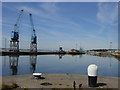
Photos of L19 2QW


Area Information
Living in L19 2QW means being part of a small, tightly knit residential cluster in England, home to 1,578 people. This postcode area is characterised by its modest scale and proximity to key transport hubs, making it a practical choice for those seeking balance between urban accessibility and quieter living. The community here is predominantly composed of adults aged 30–64, with a median age of 47, suggesting a mix of established professionals and families. While the area’s small size means it is not sprawling, its strategic location near rail networks and ferry terminals offers connectivity to larger cities and coastal destinations. Daily life here is shaped by proximity to retail outlets like Lidl Garston and Asda Garston, as well as nearby railway stations such as Cressington and Aigburth. The low flood risk and absence of environmental restrictions further enhance its appeal for those prioritising safety and planning certainty. However, the area’s compact nature means its immediate surroundings hold the bulk of its amenities and services.
- Area Type
- Postcode
- Area Size
- Not available
- Population
- 1578
- Population Density
- 1713 people/km²
The property market in L19 2QW is defined by a 32% home ownership rate, with houses being the primary accommodation type. This suggests a small, focused housing stock centred around individual properties rather than high-density developments. The low ownership percentage implies that a substantial portion of the area’s housing is rented, which could influence the availability of long-term buy-to-let opportunities. Given the area’s compact size, the immediate surroundings likely hold the bulk of its housing stock, making it a niche market for buyers seeking specific properties. The predominance of houses may appeal to those prioritising space and privacy, though the limited data on property types means the exact mix of detached, semi-detached, or terraced homes remains unclear. Buyers should consider the area’s small footprint when assessing potential growth or investment prospects.
House Prices in L19 2QW
No properties found in this postcode.
Energy Efficiency in L19 2QW
Residents of L19 2QW have access to a range of amenities within practical reach. Retail options include supermarkets like Lidl Garston, Iceland Garston, and Asda Garston, ensuring everyday shopping needs are met. The area’s rail network, with stations such as Aigburth and Cressington, connects to major routes, while nearby ferry terminals offer links to Birkenhead, the Isle of Man, and Dublin. Though the data does not specify parks or leisure facilities, the proximity to transport hubs suggests opportunities for cultural and recreational activities in nearby towns. The presence of multiple airports and ferry services also enhances the area’s appeal for those prioritising travel convenience. This mix of retail, transport, and connectivity options supports a lifestyle that balances local convenience with regional accessibility.
Amenities
Schools
| Rank | School | Type | Entry gender | Ages |
|---|
Explore more schools in this area
Go to Schools tabDemographics
The population of L19 2QW is 1,578, with a median age of 47. The most common age group is adults aged 30–64, indicating a community of middle-aged individuals and families. Home ownership stands at 32%, suggesting a significant proportion of residents rent their homes. The predominant accommodation type is houses, which aligns with the area’s residential character. The ethnic composition is largely White, with no specific data provided on other groups. This demographic profile points to a stable, mature population with established routines. The relatively low home ownership rate may reflect a mix of long-term renters and those in transitional housing phases. The absence of detailed diversity metrics means the community’s cultural composition remains less defined in the data.
Household Size
Accommodation Type
Tenure
Ethnic Group
Religion
Household Composition
Age
Household Deprivation
NS-SEC
Explore more demographic insights in this area
Go to Demographics tabPlanning
Planning Constraints
- Flood RiskPremium
- Ramsar Wetland SitesPremium
- Area of Outstanding Natural BeautyPremium
- Protected Nature ReservePremium
- Protected WoodlandPremium