Area Overview for L19 0QL
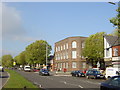
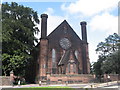
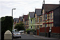
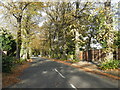
Photos of L19 0QL


Area Information
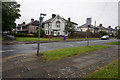
Living in L19 0QL means inhabiting a compact residential cluster in England, where 1,495 people reside across 1,605 square metres. The area’s density is striking—over 930,000 people per square kilometre—suggesting a tightly knit community. This postcode is defined by its small scale, with homes predominantly in private ownership. Daily life here is shaped by proximity to amenities, including five rail stations and multiple retail outlets. The area’s character is rooted in its practicality: residents benefit from excellent broadband connectivity and a network of transport links, including two airports and five ferry terminals. While the population is largely composed of adults aged 30–64, the median age of 47 indicates a mature, stable demographic. L19 0QL is not a place of sprawling development but a focused, functional neighbourhood where convenience and accessibility are prioritised. For those seeking a balance between urban reach and residential comfort, this area offers a compact, well-serviced environment with minimal environmental constraints.
- Area Type
- Postcode
- Area Size
- 1605 m²
- Population
- 1495
- Population Density
- 5132 people/km²
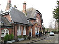
The property market in L19 0QL is dominated by owner-occupied homes, with 80% of residents living in properties they own. This high home ownership rate suggests a stable market with limited rental activity, making it less of a transient area and more of a place where residents settle long-term. The accommodation type is exclusively houses, which is notable for a postcode of this size. This implies a focus on single-family homes rather than apartments or flats, catering to households requiring private space. Given the area’s small footprint and high density, the housing stock is likely to be tightly packed, with properties closely spaced. For buyers, this means a limited selection of homes, but one that prioritises privacy and permanence. The absence of rental properties may also indicate a lower turnover rate, which could be advantageous for those seeking a stable, long-term investment.
House Prices in L19 0QL
Showing 1 properties
| Address | Type | Beds | Baths | Last Sale Price | Last Sale Date | |
|---|---|---|---|---|---|---|
| Cressington Court Care Home, Beechwood Road, Liverpool, L19 0QL | hospital_care_home | - | - | £1,000,000 | Oct 2019 |
Energy Efficiency in L19 0QL
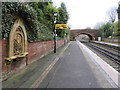
The lifestyle in L19 0QL is shaped by its proximity to a range of amenities, from retail outlets to transport hubs. Residents can access major supermarkets like Aldi Garston, Tesco Holmefield, and Asda Garston, ensuring convenience for grocery shopping. The area’s rail network, with five stations, provides easy access to nearby towns and cities, while ferry terminals such as Liverpool Pier Head and Woodside Birkenhead offer connections to Birkenhead, the Isle of Man, and Dublin. These transport links make it simple to travel for work, leisure, or commuting. The presence of multiple airports, including Liverpool John Lennon Airport, adds to the area’s accessibility. While the data does not mention parks or leisure facilities, the compact layout and high density suggest that daily life is centred around practicality and connectivity, with amenities designed to meet immediate needs rather than offering expansive recreational spaces.
Amenities
Schools
The nearest school to L19 0QL is St Austin’s Catholic Primary School, a primary institution with a good Ofsted rating. This school serves the immediate community, offering education for younger children in a setting that aligns with Catholic values. The presence of a single primary school suggests that families in the area may rely on this institution for early education, though no secondary schools are listed in the data. The good Ofsted rating indicates a satisfactory standard of teaching and facilities, which is reassuring for parents prioritising quality education. However, the absence of other schools means that families may need to travel further for secondary education or additional educational services. The school’s rating and type reflect a community that values structured, faith-based education for its children.
| Rank | School | Type | Entry gender | Ages |
|---|
Explore more schools in this area
Go to Schools tabDemographics
The community in L19 0QL is predominantly composed of adults aged 30–64, with a median age of 47. This suggests a population skewed towards middle-aged individuals, likely with established careers and families. Home ownership is high, with 80% of residents owning their homes, a figure that indicates a stable, long-term demographic. The accommodation type is primarily houses, which aligns with the area’s residential focus and suggests a preference for private, standalone properties. The predominant ethnic group is White, reflecting a homogenous population profile. While no specific deprivation data is provided, the high home ownership rate and mature age profile may imply a community with lower economic volatility. However, the absence of detailed diversity metrics means broader social dynamics remain unexplored. The area’s compact size and high density suggest a tightly knit social fabric, where familiarity and proximity are central to daily interactions.
Household Size
Accommodation Type
Tenure
Ethnic Group
Religion
Household Composition
Age
Household Deprivation
NS-SEC
Explore more demographic insights in this area
Go to Demographics tabPlanning
Planning Constraints
- Flood RiskPremium
- Ramsar Wetland SitesPremium
- Area of Outstanding Natural BeautyPremium
- Protected Nature ReservePremium
- Protected WoodlandPremium