Area Overview for L19 0QF
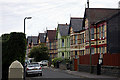
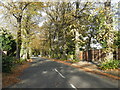
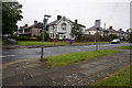
Photos of L19 0QF


Area Information
Living in L19 0QF means being part of a small, tightly knit residential cluster in England, home to 1,591 people. The area is defined by its compact size and the presence of family-oriented housing, with 63% of properties owned by residents. This postcode is characterised by a mature community, with a median age of 47 and the majority of residents falling into the 30-64 age range. Daily life here is shaped by proximity to essential services, including five rail stations and multiple retail outlets. The area’s small footprint means a sense of familiarity among neighbours, though it remains connected to larger urban networks through nearby airports and ferry terminals. For those seeking a balance between quiet living and accessibility, L19 0QF offers a base with minimal environmental constraints, such as no protected woodlands or areas of outstanding natural beauty. The low flood risk and below-average crime rates further reinforce its appeal as a stable, low-stress environment. Whether commuting to nearby cities or enjoying local amenities, residents benefit from a layout that prioritises practicality without sacrificing comfort.
- Area Type
- Postcode
- Area Size
- Not available
- Population
- 1591
- Population Density
- Not available
The property market in L19 0QF is dominated by owner-occupied homes, with 63% of properties in private hands. This contrasts with rental markets in larger urban areas, suggesting a more established, family-focused community. The accommodation type is primarily houses, which are typically larger and suited to multi-generational living or long-term occupancy. Given the area’s small size and the prevalence of owner-occupied housing, the market is likely to be competitive for buyers seeking a stable investment. The lack of high-density housing or commercial properties means the area is not geared toward short-term rentals or speculative development. For prospective buyers, this implies a focus on purchasing rather than renting, with properties offering long-term value. The limited housing stock also means that those considering the area should act promptly, as availability is likely to be constrained by the small population and existing ownership rates.
House Prices in L19 0QF
No properties found in this postcode.
Energy Efficiency in L19 0QF
Daily life in L19 0QF is enriched by a range of amenities within easy reach. Residents can shop at Aldi Garston, Asda Garston, and Tesco Holmefield, ensuring access to groceries and everyday essentials. The area’s proximity to five rail stations, including Cressington and Aigburth, facilitates commuting to nearby urban centres. Air travel is seamless, with Liverpool John Lennon Airport just a short distance away, while ferry terminals at Liverpool Pier Head and Woodside Birkenhead offer connections to Birkenhead, the Isle of Man, and Dublin. These transport options, combined with retail and rail networks, create a lifestyle that balances convenience with connectivity. The presence of multiple airports and ferry services also appeals to those who travel frequently or need international access. For residents, the area’s practical amenities ensure that daily needs are met without the need to travel far, enhancing the overall quality of life.
Amenities
Schools
Residents of L19 0QF have access to Gilmour Junior School, a primary school, and Clarendon College, an independent (private) institution. The presence of both state and independent schools offers families flexibility in choosing education options. Gilmour Junior School serves younger children, while Clarendon College provides a broader range of educational pathways, potentially appealing to parents seeking structured, fee-based education. The mix of school types reflects the area’s diversity in educational provision, though the data does not specify Ofsted ratings or academic performance. For families prioritising proximity to schools, the combination of a primary school and an independent college within reach ensures that children can access education at multiple stages. However, the absence of secondary state schools in the immediate vicinity may require commuting for older students.
| Rank | School | Type | Entry gender | Ages |
|---|
Explore more schools in this area
Go to Schools tabDemographics
The community in L19 0QF is predominantly composed of adults aged 30-64, reflecting a mature demographic with a median age of 47. Home ownership is strong, with 63% of properties occupied by owners, indicating a stable, long-term presence of residents. The area is primarily made up of houses, which aligns with the older age profile and suggests a focus on family homes rather than high-density housing. The predominant ethnic group is White, with no data provided on other demographics. The absence of specific figures on deprivation means the area’s quality of life is inferred through other metrics, such as safety and connectivity. The low crime score of 80/100 and no flood risk contribute to a secure living environment. While the data does not specify household types or diversity beyond ethnicity, the demographic profile suggests a community that values stability and continuity, with residents likely prioritising long-term residency over transient living.
Household Size
Accommodation Type
Tenure
Ethnic Group
Religion
Household Composition
Age
Household Deprivation
NS-SEC
Explore more demographic insights in this area
Go to Demographics tabPlanning
Planning Constraints
- Flood RiskPremium
- Ramsar Wetland SitesPremium
- Area of Outstanding Natural BeautyPremium
- Protected Nature ReservePremium
- Protected WoodlandPremium