Area Overview for L19 0PJ
Photos of L19 0PJ
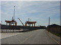
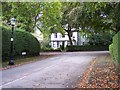
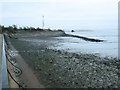
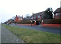
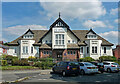

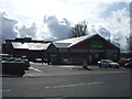
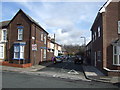

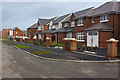
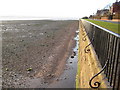
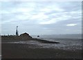
20 photos from this area
Area Information
Key information about the L19 0PJ including its size, population, and administrative classification.
- Area Type
- Postcode
- Area Size
- 2.4 hectares
- Population
- 2458
- Population Density
- 2872 people/km²
House Prices in L19 0PJ
27
Properties
£552,275
Average Sold Price
£190,000
Lowest Price
£1,050,000
Highest Price
Showing 27 properties
| Address | Type | Beds | Baths | Last Sale Price | Last Sale Date | |
|---|---|---|---|---|---|---|
| 26 Salisbury Road, Garston, Liverpool, L19 0PJ | Detached | 7 | 3 | £1,050,000 | Aug 2022 | |
| 40 Salisbury Road, Garston, Liverpool, L19 0PJ | house | - | - | £950,000 | Mar 2022 | |
| 44 Salisbury Road, Garston, Liverpool, L19 0PJ | Semi-detached | - | - | £342,857 | Mar 2021 | |
| 32 Salisbury Road, Garston, Liverpool, L19 0PJ | Detached | 5 | 2 | £620,000 | Mar 2021 | |
| 14A Salisbury Road, Garston, Liverpool, L19 0PJ | house | - | - | £635,000 | Mar 2021 | |
| 28 Salisbury Road, Garston, Liverpool, L19 0PJ | Detached | 6 | 4 | £660,000 | Sep 2016 | |
| 22 Salisbury Road, Garston, Liverpool, L19 0PJ | Semi-detached | 6 | 3 | £560,000 | Aug 2016 | |
| 24 Salisbury Road, Garston, Liverpool, L19 0PJ | Semi-detached | 6 | - | £544,000 | Aug 2013 | |
| 38 Salisbury Road, Garston, Liverpool, L19 0PJ | Terraced | - | - | £499,999 | Aug 2012 | |
| 16 Salisbury Road, Garston, Liverpool, L19 0PJ | house | - | - | £490,000 | Feb 2012 |
Page 1 of 3
Energy Efficiency in L19 0PJ
Amenities
Schools
| Rank | School | Type | Entry gender | Ages |
|---|
Explore more schools in this area
Go to Schools tabDemographics
Household Size
Family (3-5 people)
most common
Accommodation Type
Houses
most common
Tenure
68
majority
Ethnic Group
White
most common
Religion
N/A
most common
Household Composition
N/A
most common
Age
47
median
Adults (30-64 years)
most common
Household Deprivation
N/A
with no deprivation
NS-SEC
49
in Lower managerial occupations
Explore more demographic insights in this area
Go to Demographics tabPlanning
Planning Constraints
- Flood RiskPremium
- Ramsar Wetland SitesPremium
- Area of Outstanding Natural BeautyPremium
- Protected Nature ReservePremium
- Protected WoodlandPremium