Area Overview for L18 7HH
Photos of L18 7HH


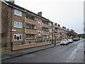
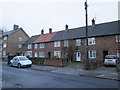
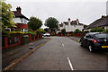
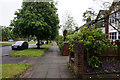
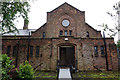
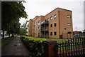
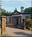
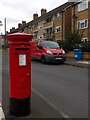


26 photos from this area
Area Information
Key information about the L18 7HH including its size, population, and administrative classification.
- Area Type
- Postcode
- Area Size
- 9519 m²
- Population
- 1533
- Population Density
- 4360 people/km²
House Prices in L18 7HH
8
Properties
£134,333
Average Sold Price
£98,000
Lowest Price
£165,000
Highest Price
Showing 8 properties
| Address | Type | Beds | Baths | Last Sale Price | Last Sale Date | |
|---|---|---|---|---|---|---|
| 167 Greenhill Road, Mossley Hill, Liverpool, L18 7HH | house | - | - | £165,000 | Aug 2009 | |
| 163 Greenhill Road, Mossley Hill, Liverpool, L18 7HH | Terraced | - | - | £140,000 | Mar 2005 | |
| 161 Greenhill Road, Mossley Hill, Liverpool, L18 7HH | Terraced | 2 | 1 | £98,000 | Jul 2003 | |
| Dog Section, Mounted Police Headquarters, 173 Greenhill Road, Mossley Hill, Liverpool, L18 7HH | commercial | - | - | - | - | |
| 171 Greenhill Road, Mossley Hill, Liverpool, L18 7HH | house | - | - | - | - | |
| 169 Greenhill Road, Mossley Hill, Liverpool, L18 7HH | Terraced | - | - | - | - | |
| 165 Greenhill Road, Mossley Hill, Liverpool, L18 7HH | house | - | - | - | - | |
| 173 Greenhill Road, Mossley Hill, Liverpool, L18 7HH | Equestrian | - | - | - | - |
Energy Efficiency in L18 7HH
Amenities
Schools
| Rank | School | Type | Entry gender | Ages |
|---|
Explore more schools in this area
Go to Schools tabDemographics
Household Size
One person
most common
Accommodation Type
Houses
most common
Tenure
67
majority
Ethnic Group
White
most common
Religion
N/A
most common
Household Composition
N/A
most common
Age
47
median
Adults (30-64 years)
most common
Household Deprivation
N/A
with no deprivation
NS-SEC
34
in Lower managerial occupations
Explore more demographic insights in this area
Go to Demographics tabPlanning
Planning Constraints
- Flood RiskPremium
- Ramsar Wetland SitesPremium
- Area of Outstanding Natural BeautyPremium
- Protected Nature ReservePremium
- Protected WoodlandPremium