Area Overview for L18 5JF
Photos of L18 5JF
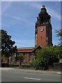
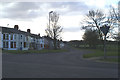
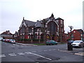
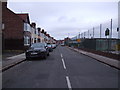
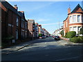

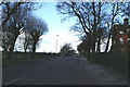
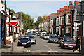
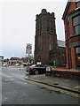
68 photos from this area
Area Information
Key information about the L18 5JF including its size, population, and administrative classification.
- Area Type
- Postcode
- Area Size
- 7948 m²
- Population
- 1496
- Population Density
- 8030 people/km²
House Prices in L18 5JF
38
Properties
£239,431
Average Sold Price
£55,000
Lowest Price
£395,000
Highest Price
Showing 38 properties
| Address | Type | Beds | Baths | Last Sale Price | Last Sale Date | |
|---|---|---|---|---|---|---|
| 16 Limedale Road, Liverpool, L18 5JF | Semi-detached | 5 | 2 | £395,000 | Feb 2025 | |
| 13 Limedale Road, Liverpool, L18 5JF | Semi-detached | 3 | 2 | £262,500 | Jan 2024 | |
| 26 Limedale Road, Liverpool, L18 5JF | Detached | 3 | - | £368,000 | Jun 2021 | |
| 31 Limedale Road, Liverpool, L18 5JF | house | 3 | 1 | £345,000 | Mar 2021 | |
| 9 Limedale Road, Liverpool, L18 5JF | Semi-detached | 4 | 1 | £390,500 | Mar 2021 | |
| 21 Limedale Road, Liverpool, L18 5JF | Semi-detached | 3 | 1 | £312,500 | Nov 2018 | |
| 17 Limedale Road, Liverpool, L18 5JF | Semi-detached | 3 | 1 | £265,000 | Sep 2015 | |
| 25 Limedale Road, Liverpool, L18 5JF | house | 3 | - | £250,000 | Jun 2012 | |
| 7 Limedale Road, Liverpool, L18 5JF | Detached | 4 | 2 | £190,000 | Jun 2011 | |
| 15 Limedale Road, Liverpool, L18 5JF | house | 3 | - | £187,500 | Jun 2011 |
Page 1 of 4
Energy Efficiency in L18 5JF
Amenities
Schools
| Rank | School | Type | Entry gender | Ages |
|---|
Explore more schools in this area
Go to Schools tabDemographics
Household Size
Family (3-5 people)
most common
Accommodation Type
Houses
most common
Tenure
77
majority
Ethnic Group
White
most common
Religion
N/A
most common
Household Composition
N/A
most common
Age
47
median
Adults (30-64 years)
most common
Household Deprivation
N/A
with no deprivation
NS-SEC
50
in Lower managerial occupations
Explore more demographic insights in this area
Go to Demographics tabPlanning
Planning Constraints
- Flood RiskPremium
- Ramsar Wetland SitesPremium
- Area of Outstanding Natural BeautyPremium
- Protected Nature ReservePremium
- Protected WoodlandPremium