Area Overview for L18 4PF
Photos of L18 4PF
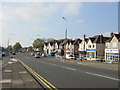


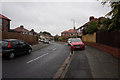
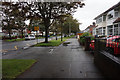
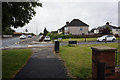


48 photos from this area
Area Information
Key information about the L18 4PF including its size, population, and administrative classification.
- Area Type
- Postcode
- Area Size
- 7427 m²
- Population
- 1266
- Population Density
- 5858 people/km²
House Prices in L18 4PF
16
Properties
£242,904
Average Sold Price
£68,495
Lowest Price
£525,000
Highest Price
Showing 16 properties
| Address | Type | Beds | Baths | Last Sale Price | Last Sale Date | |
|---|---|---|---|---|---|---|
| 31 Cooper Avenue North, Liverpool, L18 4PF | Semi-detached | 4 | 1 | £525,000 | Mar 2025 | |
| 53 Cooper Avenue North, Liverpool, L18 4PF | Semi-detached | 3 | 1 | £417,500 | Oct 2022 | |
| 59 Cooper Avenue North, Liverpool, L18 4PF | house | - | - | £390,000 | Dec 2021 | |
| 41 Cooper Avenue North, Liverpool, L18 4PF | Semi-detached | 3 | 1 | £280,000 | Jan 2019 | |
| 45 Cooper Avenue North, Liverpool, L18 4PF | Semi-detached | 3 | 1 | £300,000 | Aug 2018 | |
| 57 Cooper Avenue North, Liverpool, L18 4PF | Semi-detached | 3 | - | £250,000 | Jun 2014 | |
| 51 Cooper Avenue North, Liverpool, L18 4PF | Terraced | - | - | £169,950 | Feb 2003 | |
| 37 Cooper Avenue North, Liverpool, L18 4PF | Semi-detached | - | - | £120,000 | Apr 2000 | |
| 55 Cooper Avenue North, Liverpool, L18 4PF | Semi-detached | - | - | £68,495 | Jul 1999 | |
| 39 Cooper Avenue North, Liverpool, L18 4PF | Semi-detached | - | - | £79,000 | Jun 1997 |
Page 1 of 2
Energy Efficiency in L18 4PF
Amenities
Schools
| Rank | School | Type | Entry gender | Ages |
|---|
Explore more schools in this area
Go to Schools tabDemographics
Household Size
Family (3-5 people)
most common
Accommodation Type
Houses
most common
Tenure
95
majority
Ethnic Group
White
most common
Religion
N/A
most common
Household Composition
N/A
most common
Age
47
median
Adults (30-64 years)
most common
Household Deprivation
N/A
with no deprivation
NS-SEC
52
in Lower managerial occupations
Explore more demographic insights in this area
Go to Demographics tabPlanning
Planning Constraints
- Flood RiskPremium
- Ramsar Wetland SitesPremium
- Area of Outstanding Natural BeautyPremium
- Protected Nature ReservePremium
- Protected WoodlandPremium