Area Overview for L18 2JD
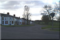
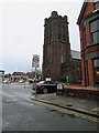
Photos of L18 2JD


Area Information
Living in L18 2JD means being part of a small, tightly knit residential cluster in England, with a population of 1529 people. This area is characterised by its modest size and the presence of family-oriented housing, predominantly houses rather than flats. The median age of 47 suggests a community of established residents, many in their middle years, with the largest age group being adults aged 30–64. Daily life here is shaped by proximity to essential services, including multiple railway stations and retail outlets. The area’s low crime risk score of 84 and negligible flood risk make it an attractive option for those prioritising safety. Families benefit from nearby schools, while commuters can access rail links to broader destinations. The mix of local amenities and strategic connectivity creates a balance between suburban tranquillity and urban accessibility, ideal for those seeking stability without isolation.
- Area Type
- Postcode
- Area Size
- Not available
- Population
- 1529
- Population Density
- 4062 people/km²
The property market in L18 2JD is dominated by owner-occupied homes, with 86% of properties in private hands. This suggests a community of long-term residents rather than a transient rental market. The accommodation type is predominantly houses, which is unusual for areas with higher flat density. This housing stock likely appeals to families or individuals seeking more space, though the small size of the area means the number of available properties is limited. Buyers should consider that the market may be competitive, with fewer options than in larger urban areas. The focus on houses also implies that the area is less suited to those prioritising investment properties or short-term rentals. For those seeking a home in this postcode, the emphasis on stability and family-friendly housing is a key factor.
House Prices in L18 2JD
No properties found in this postcode.
Energy Efficiency in L18 2JD
The lifestyle in L18 2JD is shaped by its proximity to a range of amenities, including five retail outlets such as Sainsburys Liverpool, Iceland Allerton, and Tesco Allerton, which provide everyday shopping convenience. The area’s rail network, with stations like Broad Green and West Allerton, connects residents to broader urban and regional hubs. Ferry terminals offer access to maritime travel, while the two nearby airports cater to air travel needs. Though the area is small, its strategic location near Liverpool’s core means residents can enjoy the city’s cultural and recreational offerings without long commutes. The mix of retail, transport, and travel options ensures a practical, well-connected lifestyle, balancing local convenience with wider accessibility.
Amenities
Schools
The nearest school to L18 2JD is Our Lady’s Bishop Eton Catholic Primary School, a primary institution with a ‘good’ Ofsted rating. This school serves the local community, offering education for younger children within walking distance of many homes. The absence of secondary schools in the immediate area means families may need to consider commuting for older children, but the primary school’s quality provides a solid foundation for early education. The single school listed in the data highlights the area’s focus on primary education, which may be sufficient for families with younger children but requires planning for secondary schooling. The ‘good’ rating indicates a reliable standard of teaching, though parents may seek additional information on broader educational opportunities nearby.
| Rank | School | Type | Entry gender | Ages |
|---|
Explore more schools in this area
Go to Schools tabDemographics
The community in L18 2JD is predominantly composed of adults aged 30–64, with a median age of 47. This suggests a mature, settled population, many of whom are likely to be homeowners, as 86% of properties are owner-occupied. The accommodation is primarily houses, reflecting a preference for family-friendly housing over flats. The predominant ethnic group is White, which aligns with broader regional trends. With a population of 1529, the area is small enough to foster a close-knit environment but large enough to support basic services. The high home ownership rate indicates a long-term presence of residents, contributing to a stable community dynamic. However, the lack of detailed diversity data means the full range of cultural or social characteristics remains unexplored.
Household Size
Accommodation Type
Tenure
Ethnic Group
Religion
Household Composition
Age
Household Deprivation
NS-SEC
Explore more demographic insights in this area
Go to Demographics tabPlanning
Planning Constraints
- Flood RiskPremium
- Ramsar Wetland SitesPremium
- Area of Outstanding Natural BeautyPremium
- Protected Nature ReservePremium
- Protected WoodlandPremium