Area Overview for L18 2ES
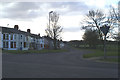
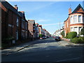
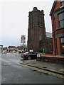
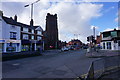
Photos of L18 2ES


Area Information
Living in L18 2ES means being part of a small, tightly knit residential cluster in England, home to 1,679 residents. The area’s compact size fosters a sense of familiarity, with daily life shaped by proximity to essential services and natural surroundings. The population is predominantly adults aged 30–64, reflecting a mature, stable community. Home ownership is high at 87%, indicating a strong presence of long-term residents. The area’s safety profile is reassuring, with low crime risk and no significant environmental hazards. Residents benefit from excellent digital connectivity, including a broadband score of 100, and practical access to rail, ferry, and airport services. While the area lacks large-scale amenities, its small footprint ensures convenience, with shops, schools, and transport hubs within easy reach. For those seeking a quiet, secure environment with strong community ties, L18 2ES offers a balanced blend of residential comfort and accessibility.
- Area Type
- Postcode
- Area Size
- Not available
- Population
- 1679
- Population Density
- 5675 people/km²
The property market in L18 2ES is characterised by high home ownership (87%) and a predominance of houses. This suggests a market skewed towards owner-occupiers rather than renters, with limited availability of rental properties. The compact nature of the area means housing stock is likely limited, making it a small, tightly held community. For buyers, this implies competition for properties, particularly as the area attracts families and professionals seeking stability. The focus on houses rather than flats or apartments may appeal to those prioritising space and privacy. However, the small size of the area means buyers should consider proximity to amenities and transport links, as expansion is unlikely. The high home ownership rate also indicates a low turnover of properties, which could affect both investment potential and the speed of transactions.
House Prices in L18 2ES
No properties found in this postcode.
Energy Efficiency in L18 2ES
Residents of L18 2ES enjoy a range of nearby amenities, including retail outlets such as Sainsburys Liverpool, Iceland Allerton, and Tesco Allerton, ensuring everyday shopping needs are met. The area’s proximity to rail stations and ferry terminals enhances its connectivity, allowing easy access to urban centres and coastal routes. While the data does not mention parks or leisure facilities, the absence of environmental constraints like AONB or protected woodlands suggests open spaces may be available nearby. The mix of retail, transport, and travel options contributes to a practical lifestyle, balancing convenience with the tranquillity of a smaller community. For those prioritising accessibility, the area’s amenities are well-suited to daily routines, from commuting to grocery shopping.
Amenities
Schools
Residents of L18 2ES have access to two independent preparatory schools: Carleton House Preparatory School and Beechenhurst Preparatory School. Both institutions cater to younger students, offering private education options for families seeking alternative schooling. The presence of independent schools suggests the area attracts households prioritising tailored education, though no Ofsted ratings are provided. The absence of state schools in the data means families reliant on public education may need to look further afield. For those valuing private schooling, the proximity of these institutions is a significant advantage. However, buyers should consider whether the schools’ curricula and facilities align with their children’s needs, as no further details on academic performance or specialisms are available.
| Rank | School | Type | Entry gender | Ages |
|---|
Explore more schools in this area
Go to Schools tabDemographics
The community in L18 2ES is predominantly composed of adults aged 30–64, with a median age of 47. This suggests a mature population, likely with established careers and family structures. Home ownership is exceptionally high at 87%, indicating a strong preference for long-term residency over renting. The area is primarily composed of houses, which aligns with the demographic profile of older, settled residents. The predominant ethnic group is White, though no specific data on diversity or deprivation is provided. The absence of younger age groups or higher rental rates implies a stable, low-turnover community. For buyers, this profile suggests a neighbourhood with consistent demand from families and professionals seeking stability. The high home ownership rate also points to limited rental availability, which could influence property values and market dynamics.
Household Size
Accommodation Type
Tenure
Ethnic Group
Religion
Household Composition
Age
Household Deprivation
NS-SEC
Explore more demographic insights in this area
Go to Demographics tabPlanning
Planning Constraints
- Flood RiskPremium
- Ramsar Wetland SitesPremium
- Area of Outstanding Natural BeautyPremium
- Protected Nature ReservePremium
- Protected WoodlandPremium