Area Overview for L18 2EH
Photos of L18 2EH
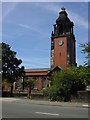
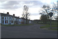
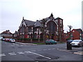
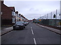
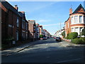

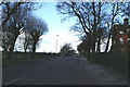
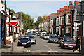
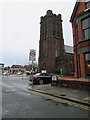
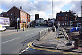
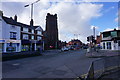
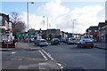
68 photos from this area
Area Information
Key information about the L18 2EH including its size, population, and administrative classification.
- Area Type
- Postcode
- Area Size
- 2.8 hectares
- Population
- 1529
- Population Density
- 4062 people/km²
House Prices in L18 2EH
35
Properties
£297,431
Average Sold Price
£210
Lowest Price
£655,000
Highest Price
Showing 35 properties
| Address | Type | Beds | Baths | Last Sale Price | Last Sale Date | |
|---|---|---|---|---|---|---|
| 45 Menlove Avenue, Mossley Hill, Liverpool, L18 2EH | Semi-detached | 4 | 1 | £550,000 | Dec 2023 | |
| 83 Menlove Avenue, Mossley Hill, Liverpool, L18 2EH | Detached | 4 | 3 | £655,000 | Jan 2018 | |
| 59 Menlove Avenue, Mossley Hill, Liverpool, L18 2EH | Semi-detached | 4 | - | £435,000 | May 2017 | |
| 19 Menlove Avenue, Mossley Hill, Liverpool, L18 2EH | Semi-detached | 4 | 1 | £455,000 | Apr 2017 | |
| 31 Menlove Avenue, Mossley Hill, Liverpool, L18 2EH | Semi-detached | 4 | - | £405,000 | Feb 2015 | |
| 57 Menlove Avenue, Mossley Hill, Liverpool, L18 2EH | house | 6 | - | £580,000 | Jul 2014 | |
| 37 Menlove Avenue, Mossley Hill, Liverpool, L18 2EH | Semi-detached | 4 | - | £345,000 | Sep 2012 | |
| 17 Menlove Avenue, Mossley Hill, Liverpool, L18 2EH | house | - | - | £362,500 | May 2010 | |
| 81 Menlove Avenue, Mossley Hill, Liverpool, L18 2EH | Detached | 4 | 2 | £491,500 | Jun 2007 | |
| 75 Menlove Avenue, Mossley Hill, Liverpool, L18 2EH | house | - | - | £370,000 | Sep 2003 |
Page 1 of 4
Energy Efficiency in L18 2EH
Amenities
Schools
| Rank | School | Type | Entry gender | Ages |
|---|
Explore more schools in this area
Go to Schools tabDemographics
Household Size
Family (3-5 people)
most common
Accommodation Type
Houses
most common
Tenure
86
majority
Ethnic Group
White
most common
Religion
N/A
most common
Household Composition
N/A
most common
Age
47
median
Adults (30-64 years)
most common
Household Deprivation
N/A
with no deprivation
NS-SEC
54
in Lower managerial occupations
Explore more demographic insights in this area
Go to Demographics tabPlanning
Planning Constraints
- Flood RiskPremium
- Ramsar Wetland SitesPremium
- Area of Outstanding Natural BeautyPremium
- Protected Nature ReservePremium
- Protected WoodlandPremium