Area Overview for L18 1LT
Photos of L18 1LT
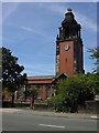
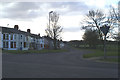
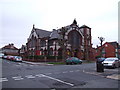
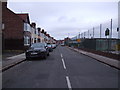
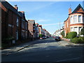

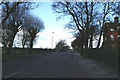
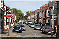
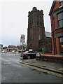
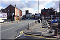
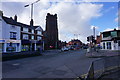
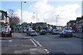
68 photos from this area
Area Information
Key information about the L18 1LT including its size, population, and administrative classification.
- Area Type
- Postcode
- Area Size
- 4941 m²
- Population
- 1449
- Population Density
- 7975 people/km²
House Prices in L18 1LT
41
Properties
£178,445
Average Sold Price
£43,000
Lowest Price
£285,000
Highest Price
Showing 41 properties
| Address | Type | Beds | Baths | Last Sale Price | Last Sale Date | |
|---|---|---|---|---|---|---|
| 14 Queensdale Road, Liverpool, L18 1LT | Terraced | 3 | 1 | £273,000 | Jul 2024 | |
| 40 Queensdale Road, Liverpool, L18 1LT | Terraced | 3 | 1 | £285,000 | Apr 2024 | |
| 28 Queensdale Road, Liverpool, L18 1LT | Terraced | 3 | 2 | £275,000 | Nov 2023 | |
| 5 Queensdale Road, Liverpool, L18 1LT | Terraced | 3 | 1 | £265,000 | Sep 2023 | |
| 18 Queensdale Road, Liverpool, L18 1LT | Terraced | 3 | 1 | £275,000 | Feb 2023 | |
| 3 Queensdale Road, Liverpool, L18 1LT | Terraced | 3 | 1 | £243,000 | Oct 2021 | |
| 21 Queensdale Road, Liverpool, L18 1LT | house | - | - | £232,500 | Sep 2021 | |
| 30 Queensdale Road, Liverpool, L18 1LT | Terraced | 3 | - | £190,000 | Sep 2021 | |
| 29 Queensdale Road, Liverpool, L18 1LT | Terraced | 3 | 1 | £225,000 | Aug 2021 | |
| 9 Queensdale Road, Liverpool, L18 1LT | Terraced | 3 | 1 | £170,000 | Feb 2021 |
Page 1 of 5
Energy Efficiency in L18 1LT
Amenities
Schools
| Rank | School | Type | Entry gender | Ages |
|---|
Explore more schools in this area
Go to Schools tabDemographics
Household Size
Family (3-5 people)
most common
Accommodation Type
Houses
most common
Tenure
64
majority
Ethnic Group
White
most common
Religion
N/A
most common
Household Composition
N/A
most common
Age
47
median
Adults (30-64 years)
most common
Household Deprivation
N/A
with no deprivation
NS-SEC
48
in Lower managerial occupations
Explore more demographic insights in this area
Go to Demographics tabPlanning
Planning Constraints
- Flood RiskPremium
- Ramsar Wetland SitesPremium
- Area of Outstanding Natural BeautyPremium
- Protected Nature ReservePremium
- Protected WoodlandPremium