Area Overview for L18 1JT
Photos of L18 1JT


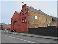
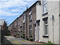

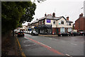
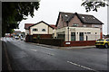

50 photos from this area
Area Information
Key information about the L18 1JT including its size, population, and administrative classification.
- Area Type
- Postcode
- Area Size
- 3053 m²
- Population
- 1756
- Population Density
- 9047 people/km²
House Prices in L18 1JT
27
Properties
£128,086
Average Sold Price
£20,000
Lowest Price
£235,750
Highest Price
Showing 27 properties
| Address | Type | Beds | Baths | Last Sale Price | Last Sale Date | |
|---|---|---|---|---|---|---|
| 49 Ivydale Road, Mossley Hill, Liverpool, L18 1JT | Terraced | 3 | 1 | £190,000 | Mar 2024 | |
| 25 Ivydale Road, Mossley Hill, Liverpool, L18 1JT | Terraced | 3 | - | £235,750 | Apr 2022 | |
| 5 Ivydale Road, Mossley Hill, Liverpool, L18 1JT | house | - | - | £215,000 | Aug 2021 | |
| 39 Ivydale Road, Mossley Hill, Liverpool, L18 1JT | Terraced | 3 | 1 | £193,000 | Jan 2019 | |
| 33 Ivydale Road, Mossley Hill, Liverpool, L18 1JT | Terraced | 2 | 2 | £164,000 | Jun 2018 | |
| 7 Ivydale Road, Mossley Hill, Liverpool, L18 1JT | Terraced | 3 | 1 | £175,000 | Apr 2018 | |
| 3 Ivydale Road, Mossley Hill, Liverpool, L18 1JT | Terraced | 3 | 1 | £145,000 | Jun 2013 | |
| 27 Ivydale Road, Mossley Hill, Liverpool, L18 1JT | Terraced | 3 | - | £122,500 | Oct 2012 | |
| 29 Ivydale Road, Mossley Hill, Liverpool, L18 1JT | house | 3 | - | £119,000 | Apr 2012 | |
| 9 Ivydale Road, Mossley Hill, Liverpool, L18 1JT | Terraced | - | - | £129,000 | Dec 2009 |
Page 1 of 3
Energy Efficiency in L18 1JT
Amenities
Schools
| Rank | School | Type | Entry gender | Ages |
|---|
Explore more schools in this area
Go to Schools tabDemographics
Household Size
Two person
most common
Accommodation Type
Houses
most common
Tenure
76
majority
Ethnic Group
White
most common
Religion
N/A
most common
Household Composition
N/A
most common
Age
47
median
Adults (30-64 years)
most common
Household Deprivation
N/A
with no deprivation
NS-SEC
43
in Lower managerial occupations
Explore more demographic insights in this area
Go to Demographics tabPlanning
Planning Constraints
- Flood RiskPremium
- Ramsar Wetland SitesPremium
- Area of Outstanding Natural BeautyPremium
- Protected Nature ReservePremium
- Protected WoodlandPremium