Area Overview for L18 1JQ
Photos of L18 1JQ
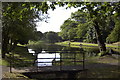
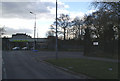
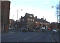
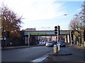
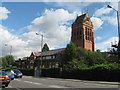
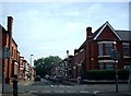
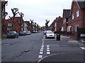
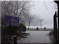
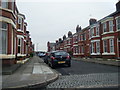
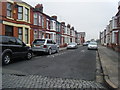
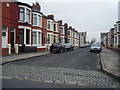
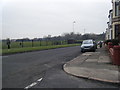
50 photos from this area
Area Information
Key information about the L18 1JQ including its size, population, and administrative classification.
- Area Type
- Postcode
- Area Size
- 6736 m²
- Population
- 2194
- Population Density
- 8261 people/km²
House Prices in L18 1JQ
26
Properties
£219,281
Average Sold Price
£42,000
Lowest Price
£322,500
Highest Price
Showing 26 properties
| Address | Type | Beds | Baths | Last Sale Price | Last Sale Date | |
|---|---|---|---|---|---|---|
| 2 Norbury Avenue, Liverpool, L18 1JQ | Terraced | 3 | 1 | £295,000 | Apr 2023 | |
| 17 Norbury Avenue, Liverpool, L18 1JQ | Terraced | 3 | 1 | £322,500 | Mar 2023 | |
| 16 Norbury Avenue, Liverpool, L18 1JQ | Terraced | 3 | 1 | £310,000 | Oct 2022 | |
| 24 Norbury Avenue, Liverpool, L18 1JQ | Terraced | 3 | 1 | £280,000 | Sep 2021 | |
| 28 Norbury Avenue, Liverpool, L18 1JQ | Terraced | 3 | 1 | £285,000 | Apr 2021 | |
| 7 Norbury Avenue, Liverpool, L18 1JQ | Terraced | 4 | 2 | £310,000 | Nov 2020 | |
| 9 Norbury Avenue, Liverpool, L18 1JQ | Semi-detached | 3 | - | £215,000 | Jul 2020 | |
| 12 Norbury Avenue, Liverpool, L18 1JQ | Terraced | 3 | - | £221,000 | Nov 2019 | |
| 13 Norbury Avenue, Liverpool, L18 1JQ | Terraced | 3 | - | £218,500 | Sep 2018 | |
| 15 Norbury Avenue, Liverpool, L18 1JQ | Terraced | 3 | - | £220,000 | Jun 2017 |
Page 1 of 3
Energy Efficiency in L18 1JQ
Amenities
Schools
| Rank | School | Type | Entry gender | Ages |
|---|
Explore more schools in this area
Go to Schools tabDemographics
Household Size
Two person
most common
Accommodation Type
Houses
most common
Tenure
69
majority
Ethnic Group
White
most common
Religion
N/A
most common
Household Composition
N/A
most common
Age
22
median
Young Adults (15-29 years)
most common
Household Deprivation
N/A
with no deprivation
NS-SEC
18
in Lower managerial occupations
Explore more demographic insights in this area
Go to Demographics tabPlanning
Planning Constraints
- Flood RiskPremium
- Ramsar Wetland SitesPremium
- Area of Outstanding Natural BeautyPremium
- Protected Nature ReservePremium
- Protected WoodlandPremium