Area Overview for L18 0HR
Photos of L18 0HR
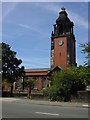
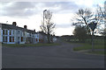
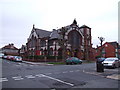
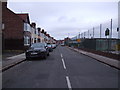
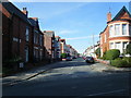

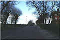
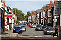
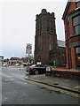
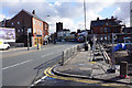
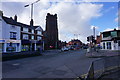
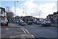
68 photos from this area
Area Information
Key information about the L18 0HR including its size, population, and administrative classification.
- Area Type
- Postcode
- Area Size
- 5054 m²
- Population
- 1496
- Population Density
- 8030 people/km²
House Prices in L18 0HR
42
Properties
£233,145
Average Sold Price
£54,000
Lowest Price
£384,000
Highest Price
Showing 42 properties
| Address | Type | Beds | Baths | Last Sale Price | Last Sale Date | |
|---|---|---|---|---|---|---|
| 26 Hallville Road, Liverpool, L18 0HR | Terraced | 3 | 2 | £384,000 | Aug 2025 | |
| 52 Hallville Road, Liverpool, L18 0HR | Terraced | 4 | 2 | £375,000 | Mar 2025 | |
| 34 Hallville Road, Liverpool, L18 0HR | house | 4 | 2 | £330,000 | Jul 2024 | |
| 4 Hallville Road, Liverpool, L18 0HR | Terraced | 1 | 1 | £170,000 | Nov 2023 | |
| 56 Hallville Road, Liverpool, L18 0HR | house | - | - | £326,000 | Jul 2021 | |
| 18 Hallville Road, Liverpool, L18 0HR | Terraced | - | - | £295,000 | Feb 2021 | |
| 30 Hallville Road, Liverpool, L18 0HR | house | - | - | £328,000 | Jan 2021 | |
| 38 Hallville Road, Liverpool, L18 0HR | Terraced | 4 | 1 | £265,000 | Dec 2019 | |
| 24 Hallville Road, Liverpool, L18 0HR | Terraced | 5 | 1 | £262,000 | Aug 2019 | |
| 40 Hallville Road, Liverpool, L18 0HR | Terraced | 4 | 2 | £277,000 | Feb 2018 |
Page 1 of 5
Energy Efficiency in L18 0HR
Amenities
Schools
| Rank | School | Type | Entry gender | Ages |
|---|
Explore more schools in this area
Go to Schools tabDemographics
Household Size
Family (3-5 people)
most common
Accommodation Type
Houses
most common
Tenure
77
majority
Ethnic Group
White
most common
Religion
N/A
most common
Household Composition
N/A
most common
Age
47
median
Adults (30-64 years)
most common
Household Deprivation
N/A
with no deprivation
NS-SEC
50
in Lower managerial occupations
Explore more demographic insights in this area
Go to Demographics tabPlanning
Planning Constraints
- Flood RiskPremium
- Ramsar Wetland SitesPremium
- Area of Outstanding Natural BeautyPremium
- Protected Nature ReservePremium
- Protected WoodlandPremium