Area Overview for L17 2BH
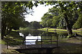
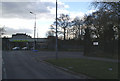
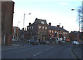
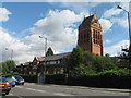
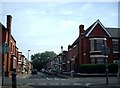
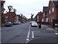
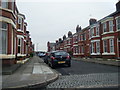
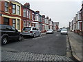
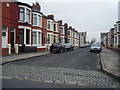
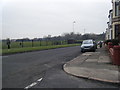
Photos of L17 2BH


Area Information
Living in L17 2BH means being part of a compact, residential postcode area in England with a population of 1232. This small cluster of homes is characterised by a mature demographic, with a median age of 47 and most residents falling within the 30-64 age range. The area’s proximity to key amenities and transport links makes it a practical choice for those seeking convenience without sacrificing a sense of community. Residents benefit from nearby schools, including the outstanding-rated Liverpool College, and access to multiple rail stations, such as Mossley Hill and Edge Hill. The area’s compact size means daily life is walkable, with local shops and services within easy reach. While it is not a high-density urban hub, L17 2BH offers a balance of residential calm and connectivity to larger cities like Liverpool. Its small footprint ensures a close-knit environment, though the limited population may mean fewer social opportunities compared to larger towns. For those prioritising practicality and accessibility, this postcode provides a straightforward lifestyle with minimal commute times to key destinations.
- Area Type
- Postcode
- Area Size
- Not available
- Population
- 1232
- Population Density
- 2196 people/km²
The property market in L17 2BH is defined by a low home ownership rate of 17%, indicating that the majority of residents are renters rather than property owners. The accommodation type is predominantly flats, which may suggest a housing stock that is either older or part of a purpose-built development. This configuration implies a rental market rather than an owner-occupied one, which could be attractive to investors or those seeking short-term housing. The small size of the area means that property availability is limited, and buyers may need to look beyond the immediate postcode for larger options. The dominance of flats may also mean that properties are smaller in size, which could be a consideration for those seeking more space. For buyers, the area’s compact nature and focus on rental properties may present challenges in finding owner-occupied homes, though it could offer opportunities for those interested in property management or investment.
House Prices in L17 2BH
No properties found in this postcode.
Energy Efficiency in L17 2BH
Residents of L17 2BH enjoy access to a variety of amenities within practical reach, including retail outlets such as Tesco Liverpool, Asda Sefton, and Aldi Wavertree. These stores provide essential shopping options for daily needs, from groceries to household items. The area’s rail network, with stations like Mossley Hill and Edge Hill, offers convenient access to public transport, reducing the need for car ownership. Ferry terminals nearby, including Liverpool Pier Head and Woodside Birkenhead, provide connections to surrounding areas, enhancing mobility. The presence of two Liverpool John Lennon Airport locations further supports travel options. While the area’s small size limits the diversity of leisure facilities, the proximity to major transport hubs and retail options ensures a practical lifestyle. The combination of retail, transport, and travel links makes L17 2BH a functional choice for those prioritising convenience over extensive local amenities.
Amenities
Schools
Residents of L17 2BH have access to a range of educational institutions, including St Hilda’s Church of England High School, a primary school with a good Ofsted rating, and Liverpool College, an academy rated outstanding. The presence of Liverpool College International, an independent school, adds diversity to the options available to families. This mix of state and independent schools provides flexibility for parents seeking either free or fee-paying education. The outstanding rating at Liverpool College suggests a high standard of teaching and resources, which is a significant advantage for families prioritising academic excellence. The good rating at St Hilda’s indicates reliable education for younger children, though it does not match the highest standards. The availability of multiple school types ensures that residents can choose between different educational philosophies and budgets, catering to a range of family needs.
| Rank | School | Type | Entry gender | Ages |
|---|
Explore more schools in this area
Go to Schools tabDemographics
The community in L17 2BH is predominantly composed of adults aged 30-64, with a median age of 47. This suggests a population skewed towards established professionals and families, though the low home ownership rate of 17% indicates that most residents are renters rather than property owners. The accommodation type is primarily flats, reflecting a housing stock that may be purpose-built or part of older developments. The predominant ethnic group is White, though the data does not specify the presence of other groups. The low home ownership percentage implies a transient population or a focus on rental properties, which may affect the area’s long-term stability. With no data on deprivation levels, it is unclear how this impacts quality of life, but the age profile suggests a community with established routines and limited reliance on childcare services. The demographic makeup indicates a mature, settled population with access to local amenities but limited opportunities for property investment.
Household Size
Accommodation Type
Tenure
Ethnic Group
Religion
Household Composition
Age
Household Deprivation
NS-SEC
Explore more demographic insights in this area
Go to Demographics tabPlanning
Planning Constraints
- Flood RiskPremium
- Ramsar Wetland SitesPremium
- Area of Outstanding Natural BeautyPremium
- Protected Nature ReservePremium
- Protected WoodlandPremium