Area Overview for L15 8FH
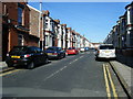
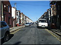
Photos of L15 8FH


Area Information
Living in L15 8FH means being part of a small, tightly knit residential cluster in England, home to 1,949 people. This postcode area is defined by its compact size and proximity to essential services, making it a practical choice for those seeking convenience without sacrificing community. The area’s youthful demographic—over a third of residents are aged 15–29—suggests a dynamic, evolving neighbourhood. Daily life here is shaped by nearby amenities, including multiple retail outlets and transport links, which cater to both local needs and broader regional connectivity. The area’s compact nature means residents can access shops, schools, and public transport within walking or short driving distance. While the population is relatively small, the presence of four primary schools and multiple rail stations indicates a focus on family-friendly infrastructure. L15 8FH is not a sprawling suburb but a well-defined postcode with a clear identity, blending residential living with practical access to urban and rural resources.
- Area Type
- Postcode
- Area Size
- Not available
- Population
- 1949
- Population Density
- 15718 people/km²
The property market in L15 8FH is characterised by a 32% home ownership rate, which is notably lower than the national average, suggesting a rental market dominates. The accommodation type is predominantly houses, which is atypical for a small postcode with a young population. This mix may indicate a blend of family homes and properties rented out by landlords, possibly catering to students or short-term tenants. Buyers in this area should consider the limited housing stock and the potential for competition in the rental market. The small size of the postcode means the immediate surroundings are critical for property searches, with nearby areas likely offering more options. For those seeking owner-occupation, the low home ownership rate may signal limited availability, but the presence of houses could appeal to those prioritising space over density.
House Prices in L15 8FH
No properties found in this postcode.
Energy Efficiency in L15 8FH
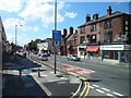
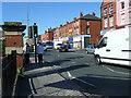
Residents of L15 8FH enjoy a range of amenities within practical reach, from retail to transport. Local shops include Aldi Wavertree, Co-op Lawrence, and Asda Sefton, providing everyday essentials. The area’s rail network is extensive, with stations like Wavertree Technology Park and Mossley Hill offering access to Liverpool’s urban core and beyond. Ferry terminals at Liverpool Pier Head and Woodside Birkenhead connect to nearby cities and islands, while proximity to Liverpool John Lennon Airport ensures easy travel. Though the area’s small size limits large-scale leisure options, the presence of multiple retail outlets and transport hubs suggests a lifestyle focused on convenience and accessibility. The mix of shops and transport links supports both daily errands and longer journeys, making L15 8FH a practical choice for those prioritising connectivity over sprawling amenities.
Amenities
Schools
Residents of L15 8FH have access to four primary schools within practical reach: Lawrence Junior School, Lawrence Infants’ School, St Bridget’s CofE Junior Mixed and Infant School, and Lawrence Community Primary School, which holds a ‘good’ Ofsted rating. This concentration of primary schools suggests a family-friendly environment, with multiple options for early education. The mix of schools includes both state and church-affiliated institutions, offering parents a choice between secular and faith-based education. The presence of a school with a ‘good’ rating indicates at least one institution meeting high standards of teaching and pupil outcomes. For families, this proximity to schools reduces commuting time and supports a lifestyle centred on local amenities. The density of educational options also implies a community prioritising the needs of children, reinforcing the area’s appeal to young families.
| Rank | School | Type | Entry gender | Ages |
|---|
Explore more schools in this area
Go to Schools tabDemographics
The community in L15 8FH is predominantly young, with a median age of 22 and the majority of residents falling within the 15–29 age range. This suggests a population skewed towards students, early-career professionals, or families with young children. Home ownership in the area is relatively low at 32%, indicating a higher proportion of rental properties. The accommodation type is primarily houses, which is unusual for a postcode with such a small population, hinting at a mix of family homes and perhaps some larger properties. The predominant ethnic group is White, though specific data on diversity or deprivation is not provided. The youthful demographic and lower home ownership rate may reflect a transient population, with residents prioritising flexibility over long-term investment. This profile aligns with an area that serves as a base for those balancing education, employment, or temporary housing needs.
Household Size
Accommodation Type
Tenure
Ethnic Group
Religion
Household Composition
Age
Household Deprivation
NS-SEC
Explore more demographic insights in this area
Go to Demographics tabPlanning
Planning Constraints
- Flood RiskPremium
- Ramsar Wetland SitesPremium
- Area of Outstanding Natural BeautyPremium
- Protected Nature ReservePremium
- Protected WoodlandPremium