Area Overview for L15 7NN
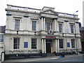
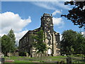
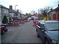
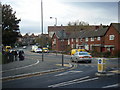
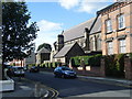
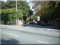
Photos of L15 7NN


Area Information
Living in L15 7NN offers a compact, residential experience shaped by its small population of 1290 and its position as a focused postcode area. The community is defined by its proximity to essential services, with homes predominantly set in traditional properties. Daily life here balances quiet domesticity with accessible connectivity, reflecting the area’s role as a practical base for families and professionals. The presence of nearby schools, rail networks, and retail hubs ensures residents have practical amenities within reach. While the area lacks large-scale infrastructure, its small size fosters a sense of familiarity. The median age of 47 suggests a stable population, with many residents likely established in their careers and communities. For buyers, L15 7NN represents a blend of simplicity and functionality, where the local character is shaped by its limited scale and the surrounding regional networks.
- Area Type
- Postcode
- Area Size
- Not available
- Population
- 1290
- Population Density
- 5031 people/km²
The property market in L15 7NN is dominated by owner-occupied homes, with 69% of properties in private hands. This suggests a stable, long-term resident base rather than a transient rental market. The accommodation type is predominantly houses, which aligns with the area’s small, residential character. For buyers, this means a focus on individual homes rather than apartments or shared housing. The limited scale of the postcode area means the housing stock is unlikely to be extensive, but the presence of traditional properties may appeal to those seeking established, family-friendly homes. Proximity to transport links and schools could enhance the area’s appeal, though the small size means buyers should consider the immediate surroundings for more options.
House Prices in L15 7NN
No properties found in this postcode.
Energy Efficiency in L15 7NN
The lifestyle in L15 7NN is shaped by its proximity to retail, transport, and regional hubs. Residents have access to five retail outlets, including Morrisons Daily, Tesco Clocktower, and Aldi Old, ensuring everyday shopping needs are met locally. The area’s rail network, with stations like Broad Green and Mossley Hill, connects to broader transport systems, facilitating commutes to work or leisure. Nearby ferry terminals, such as Liverpool Pier Head, provide links to surrounding cities and islands, while two airports offer regional air travel options. Though the area itself is small, its integration with surrounding infrastructure means residents can access a range of services without significant travel. This balance of local convenience and regional connectivity supports a practical, accessible lifestyle.
Amenities
Schools
Residents of L15 7NN have access to two primary schools: Northway Primary and Nursery School, which holds an Ofsted rating of satisfactory, and Northway Infant School. Both institutions cater to younger children, providing a range of early education options. The presence of two primary schools within the area suggests a focus on local education, reducing the need for long commutes for families. However, the absence of secondary schools or higher education facilities means residents may need to look beyond L15 7NN for comprehensive schooling. The Ofsted rating for Northway Primary indicates a moderate standard of education, which could be a consideration for families prioritising academic performance.
| Rank | School | Type | Entry gender | Ages |
|---|
Explore more schools in this area
Go to Schools tabDemographics
The community in L15 7NN is predominantly composed of adults aged 30–64, with a median age of 47. This suggests a mature, settled population, likely with established careers and family ties. Home ownership rates are high at 69%, indicating a strong preference for private residence over rental properties. The area is characterised by houses rather than flats, reflecting a traditional housing stock. The predominant ethnic group is White, though no specific diversity data is provided. The absence of detailed information on deprivation or income levels means the area’s socioeconomic profile remains opaque, but the high home ownership and age demographics imply a relatively stable, middle-income community.
Household Size
Accommodation Type
Tenure
Ethnic Group
Religion
Household Composition
Age
Household Deprivation
NS-SEC
Explore more demographic insights in this area
Go to Demographics tabPlanning
Planning Constraints
- Flood RiskPremium
- Ramsar Wetland SitesPremium
- Area of Outstanding Natural BeautyPremium
- Protected Nature ReservePremium
- Protected WoodlandPremium