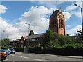
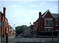
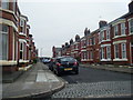
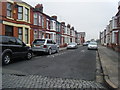
Area Overview for L15 5DQ
Photos of L15 5DQ


Area Information
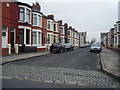
Living in L15 5DQ means being part of a small, tightly knit residential cluster in England with a population of just 1,577. This area is characterised by its compact size and the presence of houses, which dominate the accommodation type. The median age of 47 suggests a mature, stable community, with the majority of residents falling within the 30-64 age range. Daily life here is shaped by proximity to essential services and transport links. The area’s low flood risk and absence of protected natural sites mean residents face minimal environmental constraints. Safety is a key feature, with a crime risk score of 82, placing it well below average. Digital connectivity is robust, with broadband rated at 100 and mobile coverage at 85, ensuring seamless access to online services. For those prioritising security, convenience, and a balanced lifestyle, L15 5DQ offers a blend of practicality and accessibility. Its small footprint means the community feels cohesive, with residents likely to know their neighbours. Whether commuting via nearby rail stations or accessing retail hubs, life here balances tranquillity with connectivity.
- Area Type
- Postcode
- Area Size
- Not available
- Population
- 1577
- Population Density
- 5909 people/km²
The property market in L15 5DQ is defined by its mix of owner-occupied homes and rental properties, with 65% of residents owning their homes. The accommodation type is predominantly houses, which are more common than flats or other formats. This suggests a market skewed towards established, family-friendly housing rather than high-rise or modern developments. The small size of the area means the housing stock is limited, but the presence of nearby rail stations and amenities may extend the appeal to buyers considering the surrounding regions. For those seeking owner-occupied properties, the area offers a stable, low-risk environment with minimal planning constraints. However, the lack of specific data on property prices or availability means buyers should explore adjacent areas for broader options. The focus on houses implies a preference for private, spacious living, which may align with the needs of professionals or families prioritising comfort over urban convenience.
House Prices in L15 5DQ
No properties found in this postcode.
Energy Efficiency in L15 5DQ
The lifestyle in L15 5DQ is shaped by its proximity to essential amenities. Retail options include Asda Penny, Iceland Penny, and Tesco Liverpool, providing everyday shopping convenience. Rail stations like Mossley Hill and Edge Hill offer direct links to urban centres, while ferry terminals such as Liverpool Pier Head and Woodside Birkenhead connect residents to nearby towns and islands. The area’s small size means these amenities are within practical reach, reducing the need for long commutes. For leisure, the absence of protected natural sites does not detract from the area’s appeal, as the focus is on accessible, functional living. The presence of two airports, including Liverpool John Lennon, adds to the region’s connectivity. This blend of retail, transport, and travel options ensures daily life is efficient, with residents able to balance practical needs with the convenience of nearby services.
Amenities
Schools
| Rank | School | Type | Entry gender | Ages |
|---|
Explore more schools in this area
Go to Schools tabDemographics
The community in L15 5DQ is predominantly composed of adults aged 30-64, with a median age of 47. This suggests a population that is largely established, with fewer young families or retirees. Home ownership stands at 65%, indicating a mix of owner-occupied properties and rental units. The accommodation type is primarily houses, which aligns with the area’s residential character. The predominant ethnic group is White, though no specific diversity metrics are provided. The absence of detailed data on deprivation means the quality of life cannot be fully contextualised, but the low crime risk and safety score of 82 imply a secure environment. With a population of 1,577, the area is small enough to foster a sense of familiarity, yet it offers access to amenities like retail outlets and transport hubs. The demographic profile suggests a community that values stability, with a focus on practical living over high-density urbanisation.
Household Size
Accommodation Type
Tenure
Ethnic Group
Religion
Household Composition
Age
Household Deprivation
NS-SEC
Explore more demographic insights in this area
Go to Demographics tabPlanning
Planning Constraints
- Flood RiskPremium
- Ramsar Wetland SitesPremium
- Area of Outstanding Natural BeautyPremium
- Protected Nature ReservePremium
- Protected WoodlandPremium