Area Overview for L15 4PH
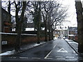
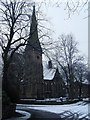
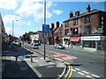
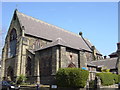
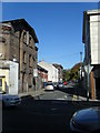
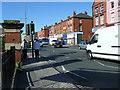
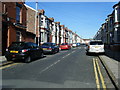
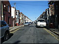
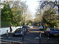
Photos of L15 4PH


Area Information
Living in L15 4PH means being part of a small, tightly knit residential cluster in England, home to 1,498 people. The area’s compact size fosters a quiet, community-focused atmosphere, with homes primarily occupied by adults aged 30–64, reflecting a median age of 47. Daily life here balances proximity to essential services with a sense of local identity. The postcode’s limited scale means residents often know their neighbours, though the area’s modest population also ensures a low-key, unassuming character. While not a bustling urban hub, L15 4PH offers practical access to nearby amenities, from schools to transport links. The presence of multiple primary schools and a secondary school caters to families, while broadband quality rated at 97/100 ensures seamless connectivity for remote work or entertainment. However, the area’s small footprint means it is best suited for those prioritising convenience over expansive space, with a focus on proximity to Liverpool’s broader infrastructure.
- Area Type
- Postcode
- Area Size
- Not available
- Population
- 1498
- Population Density
- 5619 people/km²
The property market in L15 4PH is characterised by a 39% home ownership rate, indicating that less than half of properties are owner-occupied. This suggests a rental market dominates, with many residents likely renting rather than buying. The accommodation type is primarily houses, which may appeal to families seeking more space than flats. However, the small population and limited area size mean housing stock is constrained, potentially limiting availability for buyers. For those considering purchase, the focus would be on existing homes rather than new developments. The low home ownership rate also implies competition for rental properties, which could influence affordability. Given the area’s compact nature, buyers should assess whether the proximity to amenities outweighs the limited property options.
House Prices in L15 4PH
No properties found in this postcode.
Energy Efficiency in L15 4PH
Residents of L15 4PH benefit from a range of amenities within walking or short driving distance. Retail hubs include Tesco Clocktower, Co-op Lawrence, and Aldi Wavertree, offering everyday shopping needs. The area’s proximity to ferry terminals like Liverpool Pier Head and Woodside Birkenhead provides easy access to maritime travel, while nearby airports ensure connectivity beyond the region. Rail stations such as Wavertree Technology Park and Edge Hill offer regular services to Liverpool’s city centre and surrounding areas. Though the area itself is small, its placement near larger infrastructure means residents can access cultural, leisure, and professional opportunities in nearby towns. The mix of retail, transport, and travel options contributes to a practical, well-served lifestyle without the need for long commutes.
Amenities
Schools
Residents of L15 4PH have access to a range of schools, including primary and secondary options. Heygreen Community Primary School and Heygreen Primary School both offer primary education, with the latter holding a ‘good’ Ofsted rating. Hey Green Road Infant School provides early years and primary education, while Sandown College and The Studio @ Deyes cater to secondary and further education. This mix ensures families can choose between multiple primary schools and a secondary option, though no data specifies the performance of secondary institutions beyond The Studio @ Deyes. The presence of several primary schools may ease pressure on individual institutions, but parents should verify specific ratings and catchment areas. For those prioritising education, the variety of schools in the vicinity is a practical advantage.
| Rank | School | Type | Entry gender | Ages |
|---|
Explore more schools in this area
Go to Schools tabDemographics
The community in L15 4PH is predominantly composed of adults aged 30–64, with a median age of 47. Home ownership stands at 39%, suggesting a mix of owner-occupied and rental properties. The accommodation type is largely houses, though the exact distribution of household types is not specified. The predominant ethnic group is White, which aligns with broader regional demographics. This age profile indicates a stable, mature population, likely with established careers and family structures. The lower home ownership rate may reflect a reliance on rental housing or shared living arrangements. While no specific data on deprivation is provided, the area’s moderate population size and access to services suggest a balanced quality of life, though the lack of detailed socioeconomic metrics limits deeper analysis.
Household Size
Accommodation Type
Tenure
Ethnic Group
Religion
Household Composition
Age
Household Deprivation
NS-SEC
Explore more demographic insights in this area
Go to Demographics tabPlanning
Planning Constraints
- Flood RiskPremium
- Ramsar Wetland SitesPremium
- Area of Outstanding Natural BeautyPremium
- Protected Nature ReservePremium
- Protected WoodlandPremium