Area Overview for L15 4PA
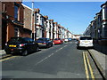
Photos of L15 4PA


Area Information
Living in L15 4PA means being part of a small, tightly knit residential cluster in England, with a population of just 1,576 people. This area is characterised by its modest scale and proximity to key transport links, making it a practical choice for those seeking a balance between convenience and community. The median age of 47 suggests a mature demographic, with the majority of residents falling within the 30-64 age range. Daily life here is shaped by the local amenities, including retail outlets like Co-op Lawrence and Asda Sefton, and easy access to rail services such as Wavertree Technology Park Station. The area’s digital connectivity is strong, with a broadband score of 100 and a mobile coverage score of 85, ensuring reliable internet for both work and leisure. While the population is small, the presence of multiple rail, ferry, and airport options within reach adds to its appeal for commuters and frequent travellers. L15 4PA is not a sprawling suburb but a focused postcode where proximity to services and transport is a defining feature.
- Area Type
- Postcode
- Area Size
- Not available
- Population
- 1576
- Population Density
- 14446 people/km²
The property market in L15 4PA is defined by a low home ownership rate of 22%, which suggests that the majority of housing stock is rented out rather than owner-occupied. This is unusual for a small residential area, where one might expect higher rates of home ownership. The accommodation type is predominantly houses, which may indicate a mix of older properties and family homes. However, the limited population size of 1,576 means that the housing stock is likely to be constrained, with limited scope for expansion. For buyers, this presents both challenges and opportunities: the small area may offer a sense of community but also limited availability of properties. The focus on houses rather than flats or apartments suggests that the area is not a high-density residential zone, which could appeal to those seeking more space. However, the low home ownership rate implies that the market may be competitive for buyers seeking to purchase.
House Prices in L15 4PA
No properties found in this postcode.
Energy Efficiency in L15 4PA
Residents of L15 4PA have access to a range of amenities that support both daily living and leisure. The retail options include major stores like Co-op Lawrence, Aldi Wavertree, and Asda Sefton, providing convenience for grocery shopping and other essentials. The area’s rail network, with stations such as Broad Green and Edge Hill, connects residents to broader transport systems, while nearby ferry terminals like Liverpool Pier Head offer easy access to maritime travel. The presence of two Liverpool John Lennon Airports within the area underscores its connectivity for both domestic and international travel. While the data does not specify parks or leisure facilities, the proximity to rail and ferry services suggests that residents can easily access cultural and recreational opportunities in nearby towns. The mix of retail, transport, and travel options creates a lifestyle that balances practicality with accessibility, making L15 4PA a viable choice for those prioritising convenience.
Amenities
Schools
| Rank | School | Type | Entry gender | Ages |
|---|
Explore more schools in this area
Go to Schools tabDemographics
The community in L15 4PA is predominantly composed of adults aged 30-64, with a median age of 47. This suggests a population that is largely established in careers and family life, with fewer younger or older residents. Home ownership here is notably low at 22%, indicating that most residents are likely to be renters rather than property owners. The accommodation type is primarily houses, which is unusual for an area with such a small population, but it aligns with the broader trend of owner-occupied housing in England. The predominant ethnic group is White, which reflects the broader demographic patterns of the region. While the data does not specify deprivation levels, the low home ownership rate may imply a reliance on rental markets and potentially limited long-term investment in property. The age profile also suggests a community that is stable but not rapidly growing, with services and amenities tailored to an adult population.
Household Size
Accommodation Type
Tenure
Ethnic Group
Religion
Household Composition
Age
Household Deprivation
NS-SEC
Explore more demographic insights in this area
Go to Demographics tabPlanning
Planning Constraints
- Flood RiskPremium
- Ramsar Wetland SitesPremium
- Area of Outstanding Natural BeautyPremium
- Protected Nature ReservePremium
- Protected WoodlandPremium