Area Overview for L15 4NF
Photos of L15 4NF


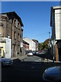
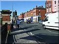
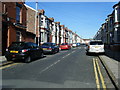
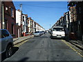
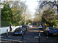
66 photos from this area
Area Information
Key information about the L15 4NF including its size, population, and administrative classification.
- Area Type
- Postcode
- Area Size
- 2811 m²
- Population
- 1498
- Population Density
- 5619 people/km²
House Prices in L15 4NF
35
Properties
£80,120
Average Sold Price
£38,000
Lowest Price
£112,000
Highest Price
Showing 35 properties
| Address | Type | Beds | Baths | Last Sale Price | Last Sale Date | |
|---|---|---|---|---|---|---|
| 26 Somerton Street, Liverpool, L15 4NF | house | - | - | £74,000 | Mar 2025 | |
| 34 Somerton Street, Liverpool, L15 4NF | house | 2 | 1 | £98,000 | Mar 2024 | |
| 16 Somerton Street, Liverpool, L15 4NF | Terraced | 2 | 1 | £97,500 | Nov 2023 | |
| 4 Somerton Street, Liverpool, L15 4NF | house | - | - | £90,000 | Mar 2023 | |
| 24 Somerton Street, Liverpool, L15 4NF | Terraced | 2 | 1 | £112,000 | Jul 2022 | |
| 32 Somerton Street, Liverpool, L15 4NF | Terraced | 2 | 1 | £108,000 | Jan 2022 | |
| 9 Somerton Street, Liverpool, L15 4NF | Terraced | 2 | 1 | £95,000 | Dec 2021 | |
| 30 Somerton Street, Liverpool, L15 4NF | house | - | - | £69,000 | Dec 2021 | |
| 36 Somerton Street, Liverpool, L15 4NF | house | - | - | £80,000 | Dec 2021 | |
| 20 Somerton Street, Liverpool, L15 4NF | house | 2 | - | £96,000 | Oct 2021 |
Page 1 of 4
Energy Efficiency in L15 4NF
Amenities
Schools
| Rank | School | Type | Entry gender | Ages |
|---|
Explore more schools in this area
Go to Schools tabDemographics
Household Size
One person
most common
Accommodation Type
Houses
most common
Tenure
39
majority
Ethnic Group
White
most common
Religion
N/A
most common
Household Composition
N/A
most common
Age
47
median
Adults (30-64 years)
most common
Household Deprivation
N/A
with no deprivation
NS-SEC
24
in Lower managerial occupations
Explore more demographic insights in this area
Go to Demographics tabPlanning
Planning Constraints
- Flood RiskPremium
- Ramsar Wetland SitesPremium
- Area of Outstanding Natural BeautyPremium
- Protected Nature ReservePremium
- Protected WoodlandPremium