Area Overview for L15 4JB
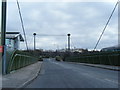
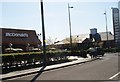
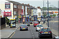
Photos of L15 4JB


Area Information
Living in L15 4JB means being part of a small, tightly knit residential cluster in England, home to 1,525 residents. The area’s compact size fosters a quiet, community-focused atmosphere, with a median age of 47 and a population skewed toward adults aged 30–64. This suggests a stable, established demographic, likely with long-term residents. The area is predominantly owner-occupied, with 62% of homes owned by their occupants, and most properties are houses rather than flats. L15 4JB is positioned for practical living, with easy access to rail, retail, and ferry services, as well as proximity to Liverpool John Lennon Airport. Its low flood risk and below-average crime rates make it an appealing choice for those prioritising safety and reliability. The absence of protected natural sites or planning constraints adds to its straightforward appeal, offering a balance of convenience and tranquillity. For buyers seeking a home with strong connectivity and a low-risk environment, L15 4JB provides a solid foundation for settled living.
- Area Type
- Postcode
- Area Size
- Not available
- Population
- 1525
- Population Density
- 5347 people/km²
The property market in L15 4JB is dominated by owner-occupied homes, with 62% of properties owned by their residents. This contrasts with areas where rental markets dominate, indicating a community of long-term residents rather than short-term tenants. The accommodation type is predominantly houses, which is unusual in areas with higher flat or apartment density. This suggests a housing stock that caters to families or those seeking more space, though the small area size means the market is limited in scope. Buyers should consider the compact nature of the area, which may restrict options for expansion or development. The high home ownership rate also implies a competitive market, with limited availability of new properties. For those prioritising stability and traditional housing, L15 4JB offers a straightforward, if constrained, option.
House Prices in L15 4JB
No properties found in this postcode.
Energy Efficiency in L15 4JB
Life in L15 4JB is shaped by its proximity to key amenities. Residents have access to five retail outlets, including Tesco Clocktower and M&S Liverpool, offering a mix of everyday shopping and more specialised retail. The area’s rail links, such as Edge Hill and Broad Green stations, provide swift access to urban centres, while ferry terminals at Liverpool Pier Head and Woodside Birkenhead offer scenic travel options. The presence of two Liverpool John Lennon Airport listings underscores the area’s connectivity for air travel. While the data does not specify dining or leisure options, the availability of major retailers and transport hubs suggests a lifestyle focused on convenience and accessibility. The compact nature of the area means amenities are within practical reach, supporting a balanced daily routine.
Amenities
Schools
| Rank | School | Type | Entry gender | Ages |
|---|
Explore more schools in this area
Go to Schools tabDemographics
The community in L15 4JB is predominantly composed of adults aged 30–64, with a median age of 47. This indicates a mature population, likely with established careers and families. Home ownership is strong, with 62% of residents owning their homes, suggesting a stable housing market. The area is characterised by houses rather than flats, reflecting a preference for traditional family homes. The predominant ethnic group is White, though no specific data on diversity or deprivation is provided. The absence of detailed diversity metrics means the community’s composition remains broadly defined. The age profile and home ownership rates imply a relatively low turnover of residents, contributing to a sense of continuity. For those considering L15 4JB, the demographic profile suggests a neighbourhood that prioritises stability, with a focus on long-term residency over transient populations.
Household Size
Accommodation Type
Tenure
Ethnic Group
Religion
Household Composition
Age
Household Deprivation
NS-SEC
Explore more demographic insights in this area
Go to Demographics tabPlanning
Planning Constraints
- Flood RiskPremium
- Ramsar Wetland SitesPremium
- Area of Outstanding Natural BeautyPremium
- Protected Nature ReservePremium
- Protected WoodlandPremium