Area Overview for L15 4HH
Photos of L15 4HH

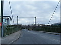
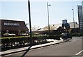
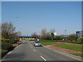
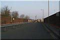

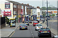


42 photos from this area
Area Information
Key information about the L15 4HH including its size, population, and administrative classification.
- Area Type
- Postcode
- Area Size
- 9867 m²
- Population
- 1498
- Population Density
- 5619 people/km²
House Prices in L15 4HH
30
Properties
£102,003
Average Sold Price
£30,250
Lowest Price
£150,000
Highest Price
Showing 30 properties
| Address | Type | Beds | Baths | Last Sale Price | Last Sale Date | |
|---|---|---|---|---|---|---|
| 118A Rathbone Road, Wavertree, Liverpool, L15 4HH | Flat | - | - | £95,000 | Jul 2025 | |
| 182 Rathbone Road, Wavertree, Liverpool, L15 4HH | Terraced | 3 | 1 | £140,000 | Apr 2022 | |
| 176 Rathbone Road, Wavertree, Liverpool, L15 4HH | house | - | - | £132,000 | Nov 2021 | |
| 154 Rathbone Road, Wavertree, Liverpool, L15 4HH | house | - | - | £137,000 | Aug 2021 | |
| 152 Rathbone Road, Wavertree, Liverpool, L15 4HH | Terraced | 3 | 1 | £145,000 | Jul 2021 | |
| 174 Rathbone Road, Wavertree, Liverpool, L15 4HH | Terraced | 3 | 1 | £125,000 | Dec 2020 | |
| 188 Rathbone Road, Wavertree, Liverpool, L15 4HH | Terraced | 3 | 1 | £150,000 | Jul 2019 | |
| 150 Rathbone Road, Wavertree, Liverpool, L15 4HH | Terraced | 2 | - | £110,000 | May 2016 | |
| 146 Rathbone Road, Wavertree, Liverpool, L15 4HH | Terraced | 2 | - | £113,000 | Sep 2015 | |
| 172 Rathbone Road, Wavertree, Liverpool, L15 4HH | Terraced | 2 | 1 | £96,500 | Feb 2015 |
Page 1 of 3
Energy Efficiency in L15 4HH
Amenities
Schools
| Rank | School | Type | Entry gender | Ages |
|---|
Explore more schools in this area
Go to Schools tabDemographics
Household Size
One person
most common
Accommodation Type
Houses
most common
Tenure
39
majority
Ethnic Group
White
most common
Religion
N/A
most common
Household Composition
N/A
most common
Age
47
median
Adults (30-64 years)
most common
Household Deprivation
N/A
with no deprivation
NS-SEC
24
in Lower managerial occupations
Explore more demographic insights in this area
Go to Demographics tabPlanning
Planning Constraints
- Flood RiskPremium
- Ramsar Wetland SitesPremium
- Area of Outstanding Natural BeautyPremium
- Protected Nature ReservePremium
- Protected WoodlandPremium