Area Overview for L15 3JJ
Photos of L15 3JJ


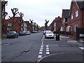
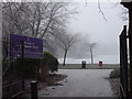
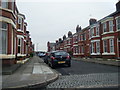
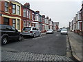
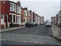
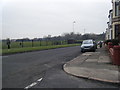
50 photos from this area
Area Information
Key information about the L15 3JJ including its size, population, and administrative classification.
- Area Type
- Postcode
- Area Size
- 5145 m²
- Population
- 1897
- Population Density
- 10785 people/km²
House Prices in L15 3JJ
50
Properties
£151,857
Average Sold Price
£59,000
Lowest Price
£314,000
Highest Price
Showing 50 properties
| Address | Type | Beds | Baths | Last Sale Price | Last Sale Date | |
|---|---|---|---|---|---|---|
| 365A Smithdown Road, Wavertree, Liverpool, L15 3JJ | Detached | 5 | 1 | £314,000 | Apr 2023 | |
| Flat 1, 339 Smithdown Road, Wavertree, Liverpool, L15 3JJ | Flat | - | - | £235,000 | Jun 2022 | |
| 353A Smithdown Road, Wavertree, Liverpool, L15 3JJ | house | 6 | 2 | £130,000 | Nov 2019 | |
| 385A Smithdown Road, Wavertree, Liverpool, L15 3JJ | Flat | - | - | £130,000 | Mar 2019 | |
| 387A Smithdown Road, Wavertree, Liverpool, L15 3JJ | Flat | - | - | £115,000 | May 2017 | |
| 355A Smithdown Road, Wavertree, Liverpool, L15 3JJ | Maisonette | - | - | £80,000 | Nov 2005 | |
| 375A Smithdown Road, Wavertree, Liverpool, L15 3JJ | Flat | - | - | £59,000 | Oct 2003 | |
| Flat 2, 337 Smithdown Road, Wavertree, Liverpool, L15 3JJ | Flat | - | - | - | - | |
| 383A Smithdown Road, Wavertree, Liverpool, L15 3JJ | Retail | 5 | - | - | - | |
| Flat 1, 373 Smithdown Road, Wavertree, Liverpool, L15 3JJ | Flat | 2 | 1 | - | - |
Page 1 of 5
Energy Efficiency in L15 3JJ
Amenities
Schools
| Rank | School | Type | Entry gender | Ages |
|---|
Explore more schools in this area
Go to Schools tabDemographics
Household Size
Family (3-5 people)
most common
Accommodation Type
Houses
most common
Tenure
31
majority
Ethnic Group
White
most common
Religion
N/A
most common
Household Composition
N/A
most common
Age
22
median
Young Adults (15-29 years)
most common
Household Deprivation
N/A
with no deprivation
NS-SEC
13
in Lower managerial occupations
Explore more demographic insights in this area
Go to Demographics tabPlanning
Planning Constraints
- Flood RiskPremium
- Ramsar Wetland SitesPremium
- Area of Outstanding Natural BeautyPremium
- Protected Nature ReservePremium
- Protected WoodlandPremium