Area Overview for L14 9NQ
Photos of L14 9NQ

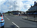

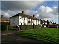
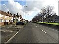
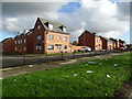


11 photos from this area
Area Information
Key information about the L14 9NQ including its size, population, and administrative classification.
- Area Type
- Postcode
- Area Size
- 1.9 hectares
- Population
- 2698
- Population Density
- 5218 people/km²
House Prices in L14 9NQ
48
Properties
£72,136
Average Sold Price
£17,364
Lowest Price
£114,950
Highest Price
Showing 48 properties
| Address | Type | Beds | Baths | Last Sale Price | Last Sale Date | |
|---|---|---|---|---|---|---|
| 582 Princess Drive, Huyton, L14 9NQ | house | - | - | £101,000 | Nov 2021 | |
| 538 Princess Drive, Huyton, L14 9NQ | house | - | - | £70,000 | Nov 2014 | |
| 610 Princess Drive, Huyton, L14 9NQ | house | - | - | £114,950 | Jun 2011 | |
| 540 Princess Drive, Huyton, L14 9NQ | Terraced | - | - | £92,500 | Aug 2008 | |
| 552 Princess Drive, Huyton, L14 9NQ | Semi-detached | - | - | £17,364 | May 2003 | |
| 594 Princess Drive, Huyton, L14 9NQ | Terraced | - | - | £37,000 | May 1999 | |
| 550 Princess Drive, Huyton, L14 9NQ | house | - | - | - | - | |
| 560A Princess Drive, Huyton, L14 9NQ | Flat | - | - | - | - | |
| 558B Princess Drive, Huyton, L14 9NQ | Flat | - | - | - | - | |
| 566 Princess Drive, Huyton, L14 9NQ | house | - | - | - | - |
Page 1 of 5
Energy Efficiency in L14 9NQ
Amenities
Schools
| Rank | School | Type | Entry gender | Ages |
|---|
Explore more schools in this area
Go to Schools tabDemographics
Household Size
Family (3-5 people)
most common
Accommodation Type
Houses
most common
Tenure
47
majority
Ethnic Group
White
most common
Religion
N/A
most common
Household Composition
N/A
most common
Age
47
median
Adults (30-64 years)
most common
Household Deprivation
N/A
with no deprivation
NS-SEC
19
in Lower managerial occupations
Explore more demographic insights in this area
Go to Demographics tabPlanning
Planning Constraints
- Flood RiskPremium
- Ramsar Wetland SitesPremium
- Area of Outstanding Natural BeautyPremium
- Protected Nature ReservePremium
- Protected WoodlandPremium