Area Overview for L14 5NZ
Photos of L14 5NZ
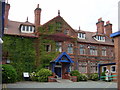
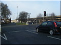
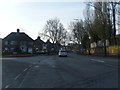
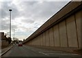
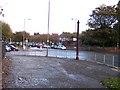
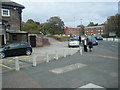
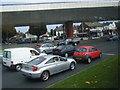
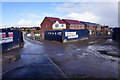
75 photos from this area
Area Information
Key information about the L14 5NZ including its size, population, and administrative classification.
- Area Type
- Postcode
- Area Size
- 7956 m²
- Population
- 1414
- Population Density
- 4814 people/km²
House Prices in L14 5NZ
27
Properties
£137,988
Average Sold Price
£65,000
Lowest Price
£239,995
Highest Price
Showing 27 properties
| Address | Type | Beds | Baths | Last Sale Price | Last Sale Date | |
|---|---|---|---|---|---|---|
| 188 Thomas Lane, Liverpool, L14 5NZ | Semi-detached | 3 | 1 | £185,000 | Nov 2013 | |
| 190 Thomas Lane, Liverpool, L14 5NZ | house | - | - | £155,000 | Oct 2009 | |
| 186 Thomas Lane, Liverpool, L14 5NZ | Semi-detached | - | - | £239,995 | Nov 2007 | |
| 184 Thomas Lane, Liverpool, L14 5NZ | Semi-detached | - | - | £155,000 | Sep 2003 | |
| 194 Thomas Lane, Liverpool, L14 5NZ | house | - | - | £149,950 | Sep 2003 | |
| 198 Thomas Lane, Liverpool, L14 5NZ | Detached | 3 | 1 | £115,000 | Nov 2002 | |
| 192 Thomas Lane, Liverpool, L14 5NZ | house | - | - | £97,000 | May 2002 | |
| 196 Thomas Lane, Liverpool, L14 5NZ | house | - | - | £79,950 | Dec 2000 | |
| 180 Thomas Lane, Liverpool, L14 5NZ | house | - | - | £65,000 | Dec 1995 | |
| 172 Thomas Lane, Liverpool, L14 5NZ | Detached | 4 | 3 | - | - |
Page 1 of 3
Energy Efficiency in L14 5NZ
Amenities
Schools
| Rank | School | Type | Entry gender | Ages |
|---|
Explore more schools in this area
Go to Schools tabDemographics
Household Size
Two person
most common
Accommodation Type
Houses
most common
Tenure
81
majority
Ethnic Group
White
most common
Religion
N/A
most common
Household Composition
N/A
most common
Age
47
median
Adults (30-64 years)
most common
Household Deprivation
N/A
with no deprivation
NS-SEC
36
in Lower managerial occupations
Explore more demographic insights in this area
Go to Demographics tabPlanning
Planning Constraints
- Flood RiskPremium
- Ramsar Wetland SitesPremium
- Area of Outstanding Natural BeautyPremium
- Protected Nature ReservePremium
- Protected WoodlandPremium